|
S08: Multilingual names, minority names
|
|
|
|
|
|
15. How and why are bilingual maps produced?
|
|
|
Bilingual maps, with toponyms and marginal
information in both the majority and the minority language may
be produced for the following reasons:
Cultural criteria
- Preservation of the cultural heritage
of a people
- Inhabitants of minority language areas
also pay taxes, so they also have the right to see their own
geographical names on the topographic maps.
Current trends
- Increased bilingual representation
or monolingual minority or regional names presentation.
- Marginal information translation more
available
Procedure
- Delimitation of minority or regional
language areas
- Introduction of bilingual transitional
periods on the map
- Restoration of minority language names
- Exclusive minority language rendering
- Accompanied with bilingual marginal
information rendering
For the demarcation of minority language areas,
language
maps are needed.
An example from a multilingual country:
Croatia. Here you can see
where the Serbian minority lives.
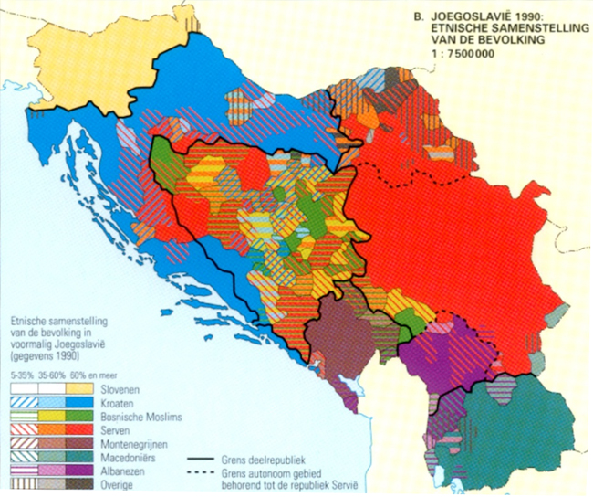
Linguistic map of the former
Yugoslavia (data from 1990). Source: Bosatlas 52nd edition.
|
  |
|
|
|
|
|
|
|