|
S08: Multilingual names, minority names
|
|
|
|
|
|
6. Topographer's bias
|
|
|
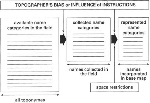
Scheme a) shows that of all name categories that can be found
in the landscape (names of road junctions, restaurants, meeting
spots, malls,settelements, rivers, mountains), only names
from a limited number of name categories are in fact collected
by topographers (names of settlements, rivers, mountains).
Of these name categories, because of space restrictions, not
all names can be inserted on the map.
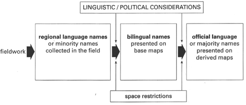
Scheme b) shows that because of linguistic or political considerations,
in the past in many countries the regional language name versions
collected in the field did not make it to the final printed
official topographic maps, but were substituted for versions
in the official language instead.
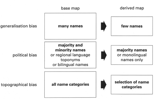
Scheme c) shows that because of generalisation, political
bias and a selection of name categories, minority names from
areas with dispersed settlements are less likely to make it
to smaller scale topographic maps (see next
page, from the Basque/speaking area in the French Pyrenees
for an example).
|
  |
|
|
|
|
|
|
|