| |
ICHC
2005 Academic Programme
Saturday, 16 July, 2005
ISCEM
(International Society of Curators of Early Maps) Kalocsa Tour !
 CATHEDRAL'S
LIBRARY EXHIBITION, KALOCSA CATHEDRAL'S
LIBRARY EXHIBITION, KALOCSA
Monday, 18 July, 2005
18.30 Opening the special map exhibition:
MARGARITAE
CARTOGRAPHICAE:
Treasures of the National Library |
in National
Széchényi Library |
Wednesday, 20 July, 2005
18.30 Opening the map exhibition:
EARTH AND
SKY:
Astronomy and Geography at the
University |
in Eötvös University Library |
Thursday, 21 July, 2005
18.30 Opening of a special
map exhibition
MILITARY MAPS
IN HUNGARY
from the 16th to the 20th century |
 in
the in
the
Military Historical Institute and Museum |
18.00 Farewell
dinner
at Lazar Horse Park, Gödöllő! NEWSee
more information!!!
Saturday, 23 July, 2005 Tour
to Pannonhalma
Benedictine Archabbey, Sacred
Places on Maps
exhibition
Post-Conference Tour "Blue
Danube"
Sunday, 24 July, 2005: Sacred
Places on Mapsexhibition in Pannonhalma
Monday, 25 July, 2005: Special map tours to: Vienna
Cirty Museum and the Austrian National Library, Vienna,
Austria
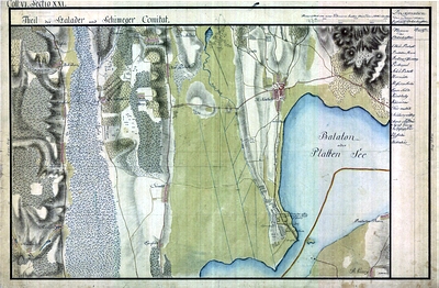
Tuesday, 26 July, 2005 : The Danube on Old Mapsexhibition
in Esztergom
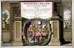
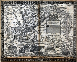
MARGARITAE CARTOGRAPHICAE
SPECIAL EXHIBITION FOR THE
21ST INTERNATIONAL CONFERENCE ON THE HISTORY OF CARTOGRAPHY
OPEN: 1922, JULY 2005, FROM 10 AM
TO 5 PM
NATIONAL SZÉCHÉNYI LIBRARY, MAP DEPARTMENT, THE 6TH FLOOR
BUDAPEST, BUDAVÁRI PALOTA F BUILDING
by Katalin Plihál
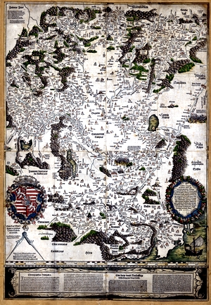
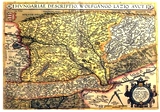
1. Tabula Hungarie ad quator latera per Lazarum
Ingolstadt,
1528.
2. Tabula Hungarie ad quator latera per Lazarum quondam
Thomae Strigonien[sis] Cardin[alis] secretarium virum expertum congesta
Venezia, 1553, A. Vavassore
3. Ligorio, Pirro: Nova descriptio totius Hungariae...
Roma. 1559, M. Tramezini
4. Nova descriptio totius Hungariae. Roma. 1559, [A. Lafreri]
5. Nova descriptio totius Hungariae. Roma. post 1577,
Cl. Duchetti
6. Nova descriptio totius Hungariae. Roma. 1602, J. Orlandi
7. Vngariae Tanst[etteriana] descriptio nvnc correcta,
et avcta Maximil[iano] II. avg[usto] opt[imo] pr[incipi] p[atri] p[atriae]
dicata
[Vienna] 1566, J. Samb[ucus]
8. Müller, Johann Christoph: Augustissimo Romanorum imperatori
Iosepho I
regni Hungariae
Wien. 1709.
9. Honter, Johannes: Chorographia Transylvania Sybenbürgen.
Basileae.1532,
10. Lipszky, Joannes: Mappa generalis Regni Hungariae
Pesthini, 1806.
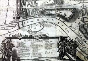
11.Coronelli, Vincenzo: Corso del Danubii de Vienna sina
Nicopoli e paesi adiacenti. Venetia, 1690, V. Coronelli.
12. Sambucus, Iohannes: Transilvania. Sibembürgen. Vienne.
1566.
13. Lazius, Wolfgang: Des Khünigreichs Hungern sampt
seinen eingeleibten Landen gründliche und warhafftige Chorographica Beschreybung
Wien. 15521556.
14. Fundanus, Nicander Philippius: Nova et exactissima
totius Ungariae
Roma. 1595.
15. Müller, Ignaz: Mappa geographica novissima regni
Hungariae
Vienna. 1769.
16. Caert-Thresoor, inhoudende de Tafelen des gantsche
Werelts Landen
Middelbruch. 1598, Barent Langenes.
17. Huber, Joseph Daniel von: Scenographie oder geometrisch.
perspect. Abbildung der
Stadt Wienn
aufgenommen und gezeichnet vom Jahr
1769 May Monats, biss letzten October 1774. Wien. [1777]
18. Terrestial globe by Matthaeus Greuter. Rome. 1632,
diameter: 49 cm
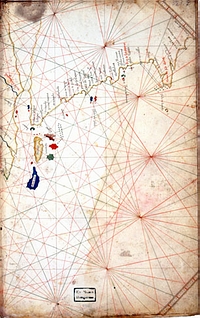
19. Benincasa, Gratiosus: Mappa maritime
Venezia, 1474.
20. Bertelli, Ferrando: Civitatum aliquot insignorum,
Venetia 1568
21. Honter, Iohannes: Rudimentorum Cosmographicorum. Corona,
1542.
22. Ligorio, Pirrho: Urbis Romę, totius olim orbis domitricis,
situs: cum adbus extantibus, sacrosant tę uetus tatis monumentis.
Roma, cca. 1552.
23. Visscher, Claes Jansz.: De Stat Olinda de Pharnambuco,
verovert by den E. General Hendrick C. Lonck, Anno 1630. Amsterdam.
post 1630
24. Lubin, E[ilhard]: Nova illustrissimi principatus Pomeraniae
descriptio
25. [An IATO Atlas compiled by Ferrando Bertelli ? Venice,
1571?]
26. Terrestial globe by László Perczel. Manuscript. Diameter
132 cm.
27. Blauw, Willem Iansz.: Pascaarte van alle de Zecusten
van Europa. Amsterdam, 1621 or later, printed on vellum.
28. Gherritsz, Hessel: [Zeekaart van de Indische Oceaan].
Amsterdam. 1621. manuscript on vellum
29. Gerritsz, Hessel: [Zeekaart van de Atlantische Oceaan].
Amsterdam. 1623. manuscript on vellum
30. Rota, Martino: Il vero ritratto di Zarra et di Sebenico
[Venezia.] 1570.
31. MItchell, John: A map of the British and French Dominions
in North America, with the roads, distances, limits, and extent of the
settlements, humbly inscribed to the Right Honourable the Earl of Halifax,
and the other Right Honourable the Lords Commissioners for Trade &
Plantations, by their Lordships most obliged and very humble servant Jno.
Mitchell. Tho: Kitchin, sculp. [London], 1755.
32. Jefferys, Thomas: The county of York, survey'd in
MDCCLXVII, VIII, IX and MDCCLXX. [London] 1772.
33. Séguin, Jean: Carte particuliere du duché Bourgogne
. Dressée et exécutée par le Sr. --- [Paris]. 1763.
34. Mappa von dem Land ob der Enns ... in dem Jahre 1781
reducirt, und in Kupfer gestochen von C. Schütz und geschrieben von F.
Müller. 1787.
35. Adrichom, Christian: Ierusalemi, et suburbia eius,
sicut tempore Christi floruit, cum locis, in quibus Christ. passus est:
quae religios? ? Christiani obseruata
descripta per ---. Coloniae
Agrippae, 1584
36. Vetter, Johann Georg: Tabula geographica nova exhibens
partem infra montanam Burggraviatus Norimbergensis sive principatum Onolsbacensem.
[Norimbergae.] 1719
37. Gerard, Hessel: Typus Hispaniae ab --- delineata et
juxta annotationes
Andreae dAlmada... [Amsterdam] 1613,
38. Kaerius, Petrus: Italiae, Sardiniae, Corsicae, &
confinium regionum nova tabula, effigies praecipuarum urbium et habituum
inibi simul complectens. Excudit ---. Amstelodami. 1607
39. Péchy Imre: A Tátra hegység domborművü térképe.
Relief-Karte des Hohen Tátra-Gebirges. M. 1=800°. Budapest, 1875,
40. [Nagy Károly]: Első magyar Földteke a legujabb kutfők
után. Metszette Biller. Bécs. 1840,
41. Dien Károly: [Éggömb.] Paris. 1840,
42. Földközi-tenger medencéjének hajózási térképe. S.
l. post 1558, manuscript on vellum
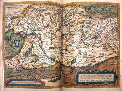
ASTRONOMY
AND GEOGRAPHY
AT THE UNIVERSITYBETWEEN THE 15TH AND 18TH CENTURIES
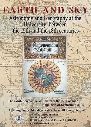
RARE COLLECTIONS OF THE UNIVERSITY LIBRARY
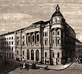
The University Library of Eötvös Loránd University is
one of the oldest and even recently active public library in Hungary. Genesis
of the Universitys library can be traced back to a jesuite colleges library
which was founded in 1561. The University was founded in 1635 by Pázmány
Péter, the Archbishop of Esztergom, in Nagyszombat. The university and
the library moved to Buda in 1777, then in 1784 to Pest. The palace of
the library, where the present collection is exhibited, was erected as
the first library-building in Hungary between 18731876. Recently, the
complete stock of the University Library consists of more than 3,6 million
volumes. We have 185 codices, among them one should mention first of all
14 codices of the Bibliotheca Corviniana, 1150 incunabula and 2600 old
Hungarian printed books, lot of maps (printed and manuscript), valuable
engravings, small-prints and several special books (first editions or dedicated
exemplars). The Rare Books Department of the University Library was established
in 2000. Nowadays we work on the rares books computer database, which
consists of the most important fields like signature, author, title, imprint,
physical description, reference note, subjects as personal name, corporate
name (especially possessors), geographic name and photos (jpg-format) for
the titlepage, the binding and the manuscript note (they are available
in our on-line catalogue). The Antiqua Collection (15011600) consists
of 7200 volumes, including 9400 different works with several exemplars.
Saying it proudly: our antiqua collection is the second in Hungary. During
the last years we have established The Baroque Collection (16011700) and
The Enlightenment Collection (17011800), which consists of about
45.000 volumes. These rare books (15011800) form a especialised collection
for university education. Thanks to the jesuit science our library covers
not only theological, medical, juristical but also arithmetical, geografical
and natural science.
Budapest, July 20, 2005.
This exhibition was prepared by
Klára Boross
Farkas Gábor Farkas
Ferenc Soproni
Róbert Szvorényi
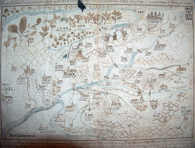
MILITARY MAPS IN HUNGARY
from the 16th to the 20th century
Hadtörténeti Intézet és Múzeum (Bp, 1014. Kapisztrán
tér 2-4)
Organizers:
dr. Jankó, Annamária,
dr. Suba, János Hegedüs, Ábel
 From
Wolfgang Lazius: Karte des ungarischen Kriegsschauplatzes vom Jahre 1556
to WWI maps of battle fields, plans of fortifications castles, troop
map, arial photos, etc., c. 30 items.térkép From
Wolfgang Lazius: Karte des ungarischen Kriegsschauplatzes vom Jahre 1556
to WWI maps of battle fields, plans of fortifications castles, troop
map, arial photos, etc., c. 30 items.térkép
 I.,
II., III. military survey kb. 15 maps I.,
II., III. military survey kb. 15 maps
Hungarian maps made between WWI and WWII 8-10 maps
Kalocsa exhibition the list can
be downloaded from here as a PDF document!
|
|