3.3 Dimensions of map symbols
No deviations from the given dimensions within these specifications are permitted. It is however accepted that due to limitations in printing technology the final map symbol dimensions may vary up to +/- 5%.
Dimensions in this book are given at the printed scale of 1:15 000.
All line widths and symbol dimensions must be kept strictly to their specified value. Certain minimum dimensions must also be observed. These are based on both printing technology and the need for legibility.
MINIMUM DIMENSIONS of 1:15 000
- The gap between two fine lines of the same colour, in brown or black: 0.15 mm
- The smallest gap between two blue lines: 0.25 mm
- Shortest dotted line: at least two dots
- Shortest dashed line: at least two dashes
- Smallest area enclosed by a dotted line: 1.5 mm (diameter) with 5 dots
- Smallest area of colour
- Blue, green, grey or yellow full colour: 0.5 mm2
- Black dot screen: 0.5 mm2
- Blue, green or yellow dot screen: 1.0 mm2
All features smaller than the dimensions above must be either exaggerated or omitted, depending on whether or not they are of significance to the orienteer. When a feature is enlarged, neighbouring features must be displaced so that the correct relative positions are maintained.
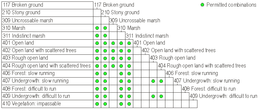
SCREENS
Vegetation, open areas, marshes, etc. are shown with dot or line screens. The following table lists the permissible combinations of screens.