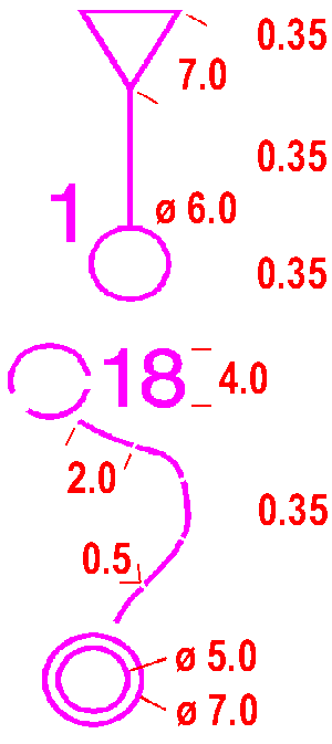
The start or map issue point (if not at the start) is shown by an equilateral triangle which points in the direction of the first control. The centre of the triangle shows the precise position of the start point.
Colour: purple.
702 Control point
The control points are shown with circles. The centre of the circle shows the precise position of the feature. Sections of circles should be omitted to leave important detail showing.
Colour: purple.
703 Control number
The number of the control is placed close to the control point circle in such a way that it does not obscure important detail. The numbers are orientated to north.
Colour: purple.
704 Line
Where controls are to be visited in order, the start, control points and finish are joined together by straight lines. Sections of lines should be omitted to leave important detail showing.
Colour: purple.
705 Marked route
A marked route is shown on the map with a dashed line.
Colour: purple.
706 Finish
The finish is shown by two concentric circles.
Colour: purple.
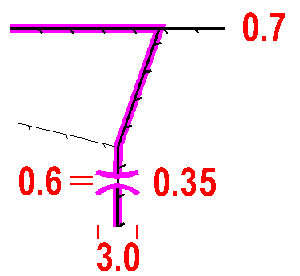
A boundary which it is not permitted to cross.
Colour: purple.
708 Crossing point
A crossing point through or over a wall or fence, or across a road or railway or through a tunnel or an out-of-bounds area is drawn on the map with two lines curving outwards.
Colour: purple.
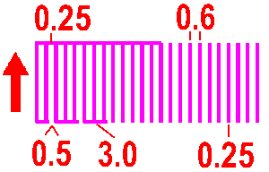
An out-of-bounds area, see also symbol 528, is shown with vertical stripes.
A bounding line may be drawn if there is no natural boundary, as follows:
- a solid line indicates that the boundary is marked continuously (tapes, etc.) on the ground,
- a dashed line indicates intermittent marking on the ground,
- no line indicates no marking on the ground.
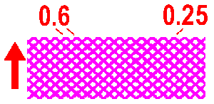
An area presenting danger to the competitor is shown with cross-hatched diagonal lines.
Colour: purple.

A route which is out-of-bounds is shown with crosses.
Colour: purple.

The location of a first aid post.
Colour: purple.
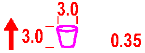
The location of a refreshment point which is not at a control.
Colour: purple.


