Magnetic north lines are lines placed on the map pointing to magnetic north. Their spacing on the map should be 33.33 mm which represents 500 m on the ground at the scale of 1:15 000. For maps with other scales lines placing should be at intervals which represents a round number of meters (e.g. 50 m, 100 m, 250 m, 500 m) and the spacing should be between 20 mm and 40 mm on the map. North lines may be broken where they obscure small features such as boulders, knolls, cliffs, stream junctions, path ends, etc. In areas with very few water features, blue lines may be used.
Colour: black (blue).
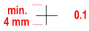
At least three registration marks must be placed within the frame of a map in a non- symmetrical position. In addition, a colour check should also be possible.
Colour: all printed colours.
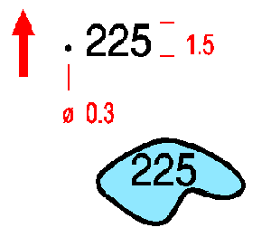
Spot heights are used for the rough assessment of height differences. The height is given to the nearest metre. The figures are orientated to the north. Water levels are given without the dot.
Colour: black.


