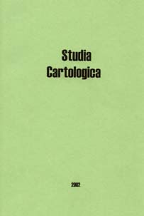
Szerkesztette: Dr. Klinghammer István
Felelős kiadó: az ELTE Eötvös Kiadó vezetője
1056 Budapest, Szerb u. 21-23.
ISBN 963 463 540 7
A kiadást támogatta az OTKA T-025842
és T-032427 sz. pályázat
2002.
TARTALOMJEGYZÉK / CONTENT
KLINGHAMMER ISTVÁN: Kartográfia - tudomány-e
a térképkészítés? / Cartography - is mapmaking
a science? (PDF)
GYÖRFFY JÁNOS: Rectangular pseudopolyconic
projection for geographical maps (PDF)
GYÖRFFY JÁNOS: Az egész Föld
optimális ábrázolása általános torzulású
pólusvonalas képzetes hengervetületben - Representing the
whole Earth in best pseudocylindrical projections with pole line (PDF)
JUHÁSZ PÉTER: Optimal projections
by means of convex linear combination (PDF)
DUTKÓ ANDRÁS - MÁRTON MÁTYÁS: A
tengerfenék domborzatának bemutatása multimédiás
módszerekkel - Representation of undersea relief with multimedia methods
MÁRTON MÁTYÁS: Az
izovonalas domborzatábrázolás és a vertikális
generalizálás - Representation of the relief with contour lines
and the vertical generalization
KLINGHAMMER ISTVÁN: Egy eurokonform földrajzi
tankönyv és iskolai zsebatlasz - a XVI. századi Magyarországból
- A Euroconform geographical schoolbook and atlas from the 16th century Hungary (PDF)
NEMERKÉNYI ZSOMBOR: Magyar térképész
az Afrika-kutatásban - A Hungarian cartographer in the African
discovery (PDF)
TÖRÖK ZSOLT: Almásy László
és a Líbiai-sivatag expedíciós térképezése
- László Almásy and the expeditionary mapping of the
Lybian-desert (PDF)
BARTOS-ELEKES ZSOMBOR: A képpé formált
adat: a népesség- szerkezeti térképek ábrázolási
módszereiről - Data transformed to image: about the representation
methods of the population structure maps (PDF)
FARAGÓ IMRE: A magyar névhasználat változásai
a Kárpát- medencét ábrázoló térképeken
- Changes of the Hungarian names usage on the maps of Carpathian-basin (PDF)
ZENTAI LÁSZLÓ: Ahogy
elkezdődött… Lajosforrás, az első magyar digitális
térkép - The beginnings... Lajosforrás, the first
Hungarian digital map
VARGA GÁBOR: Magyarország repülőterei
térképen - Map of the Hungarian airports (PDF)
PŐDÖR ANDREA: A halak tartózkodási
helyének horgásztérképeken történő
optimális ábrázolásának vizsgálata - Examination of the optimal representation of the residence of fishes on maps (PDF)
JOSÉ JESÚS REYES NUNEZ: Teaching
map concepts for children across the web: a study (PDF)
GERCSÁK GÁBOR: Hungarian geographical
names in English language publications (PDF)
KOVÁCS BÉLA: ELTE-KöM permanens
GPS-állomás - ELTE-KöM permanent GPS-station (PDF)
A szerzők (a cikkek sorrendjében)
 Klinghammer István |
 Györffy János |
 Juhász Péter |
 Dutkó András |
 Márton Mátyás |
 Nemerkényi Zsombor |
 Török Zsolt |
 Bartos-Elekes Zsombor |
 Faragó Imre |
 Zentai László |
 Varga Gábor |
 Pődör Andrea |
 Jesús Reyes |
 Gercsák Gábor |
 Kovács Béla |