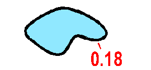
Large areas of water are shown with dot screen. Small areas of water should be shown with full colour. A black bank line indicates that the feature cannot be crossed.
Colour: blue 50% (60 lines/cm), black.
See minor changes in August 2003
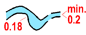
An uncrossable river or canal is drawn with black bank lines. The bank lines are broken at a ford.
Colour: blue 50% (60 lines/cm), black.
See minor changes in August 2003

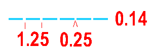
A crossable watercourse, minimum 2 m wide. The width of watercourses over 5 m wide should be shown to scale.
Colour: blue.

A crossable watercourse (including a major drainage ditch) less than 2 m wide. For better legibility a ditch in a marsh should be drawn as a crossable watercourse (305).
Colour: blue.
A natural or man-made minor water channel which may contain water only intermittently.
Colour: blue.
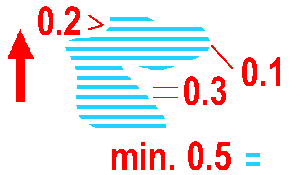
A marsh which is uncrossable or dangerous for the competitor. A black line surrounds the symbol.
Colour: blue, black.
See minor changes in August 2003
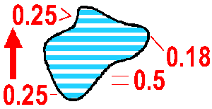
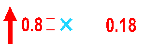
A crossable marsh, usually with a distinct edge. The symbol should be combined with vegetation symbols to show runnability and openness. Where a small marsh area should be combined with either 403/404 it is permitted to use 401/402 to improve legibility.
Colour: blue (with yellow/green).
A special small water feature. The definition of the symbol must always be given in the map legend.
Colour: blue.


