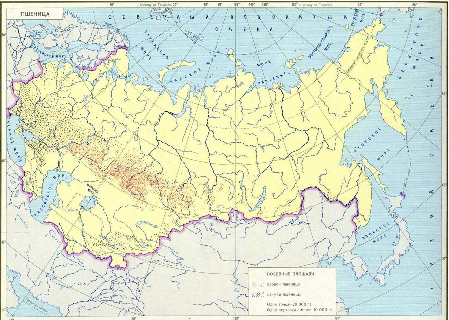
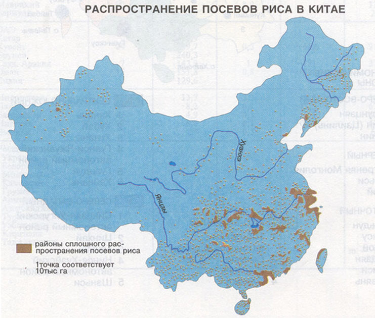
Dot method is used when cartographing mass scattered events. When marking some quantity of units of the event is mapped with the help of dots or more precisely with the help of circles. They are placed on the map in such points where this event is directly occur. For example maps of sown areas for different crops, maps of population location (especially rural population), maps of cattle breeding (USSR Atlas, 1983). As a result some number of dots of the same size and of the same value are placed on the map and their compactness gives a view about location of the event, i.e. places with the largest and the smallest concentration, and the number of dots allows to count the number of objects. This method is especially effective for the events with contrast distribution.
In a dot method of representation the most important aim is an expedient choice of dot's "weight", i.e. quantity of objects that are expressed by one dot. Then if the weight of the dot is great the distribution of dots in places with the highest concentration of the event will be more easier, but there will be some difficulties with marking single groups of objects that are less than the weight of the dot. If a group of objects can't be marked with a dot of the determined weight, several groups of objects are combined in such a way that in total they will have the weight of one dot. Then this dot is placed at the location of the biggest group.
Dots with the low weight are very convenient for the regions with the low compactness of event, but they can merge at the regions with high compactness.
As a rule a dot's weight is the most low of all the possible, but it`s necessary to take into account that they must not merge, as it makes impossible to count them. But still some maps represent only geographical peculiarities of the events location, so the merge of dots in the places of their high compactness is possible.
Simplicity and clearness of the dots method causes its wide used, especially since its possible to reproduce quantitative correlations of different events with the help of bringing in colored dots
Shape of the dot has no principal meaning; it can be presented as a shape of any other geometrical figure. In domestic cartography circles were traditionally used for marking "dots" as they are more distinct and economical. Use of any other geometrical figures for a "dot" can be applied when there is no opportunity for using dots of different colors.
Dots of different (two, three and more) weights are used in case if it is necessary to keep the peculiarities of event in the regions with low compactness and to provide clearness of dots in the regions with maximum compactness.
While performing a map its necessary to remember that the basis and inscriptions that are very striking can reduce the effect of perception. That's why while making such maps inscriptions are usually taken away and the basis is paled or brought to the background using delicate half-tones.
On the electronic maps this method of representation can look as blinking dots, for example, it is necessary to show Ukrainians on the territory of the USSR or on the map of USSR peoples.