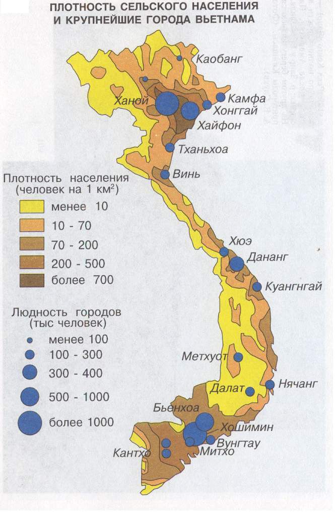
Diagrammatic map is a method of representation of some kind of event within the limits of a particular territorial unit (often administrative), which is not connected with real subdivision of this very event. For example, to show the average density of population through areas and regions that is expressed by the number of people per one square kilometer; or average forest spreading that is expressed by the proportion of the forest lands to the square of the area or district in a whole.
Unlike diagram maps that use absolute values, diagrammatic maps use relative indexes as an initial data.
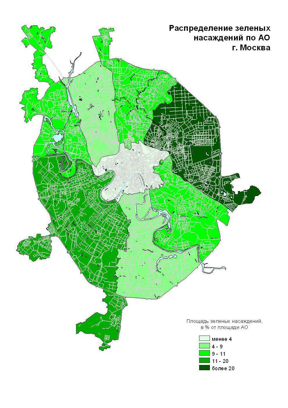
Diagrammatic map are often used for characterizing the event's change within the time with the help of relative indexes, for example squares of green plantations at the administrative districts of Moscow.
The territorial unit is colored or hatched in such a way that the richness of the color represents the intensity of the event.
While building diagrammatic map both step scale and continuous scale can be used. While using the step scale a color of some graduation of the scale is given to a territory. Intensity of the color corresponds with some particular interval. In case solid scale the intensity of coloring or hatching is in proportion to the average intensity of the event. Thus the scale points to the intensity for the round indexes. And intermediate values in their turn regarding round indexes to them can be settled by eye interpolation.
The main advantage of diagrammatic maps is the simplicity of their building and perception.
But diagrammatic map do not reflect the differences in the events' intensity within territorial units.
They make a general effect that the event is equally spread within the limits of territorial units and that the intensity is changing at its borders. Though the character of distribution may vary greatly within territorial units and stay the same when passing the border. The true character of event's distribution is distorted because of the absence of the connection between natural subdivision of the event and a territorial division that was chose for diagrammatic map.