Method of qualitative and quantitative background.
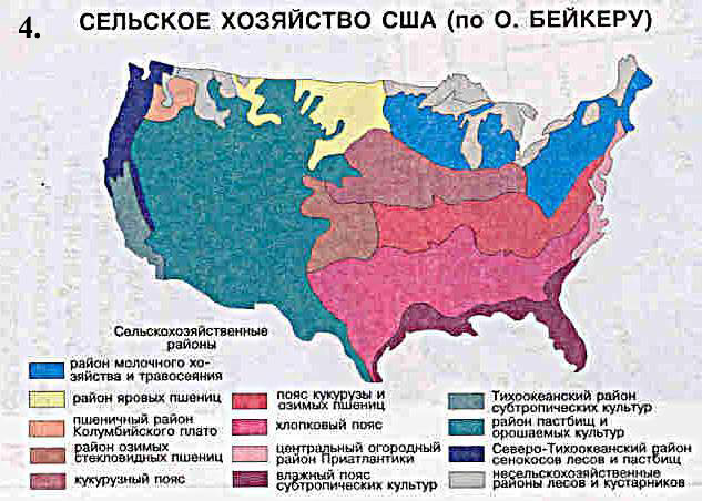
Method of qualitative background is used in order to divide territories for homogeneous regions in qualitative meaning, that are distinguished by given natural, economic or by political-administrative features. Qualitative background is used to characterize solid phenomenon that occupy huge territories (for example soils or geographical zones) or have massive spreading (for example, wheat cultivation).
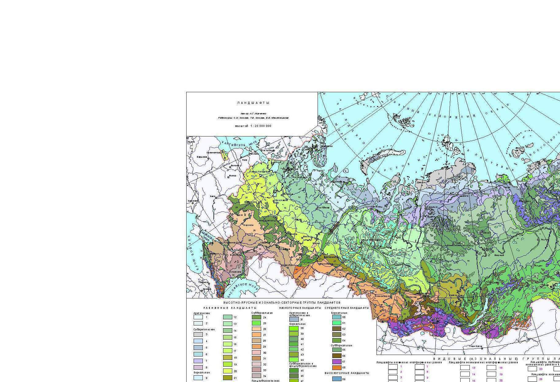
Two main methods are used in order to divide territories. The first one is the division of territories, taking into account types of area according to the accepted classification, for instance landscape or geobotanical. For this purpose classification of the phenomena, that is being represented can be created and then according to it homogeneous districts are picked out; after this homogeneous districts are painted according to the color that is assigned to this type or they can be shaded. Replacement of color or shade by inscriptions or by numbers lowers clearness that is typical for this type of representation. The second method is an individual regional subdivision into districts, i.e. division into non-recurrent districts, for example, agricultural division into districts or climatic division where the distinguished areas are signed by their own names (Siberian region, the Pacific region).
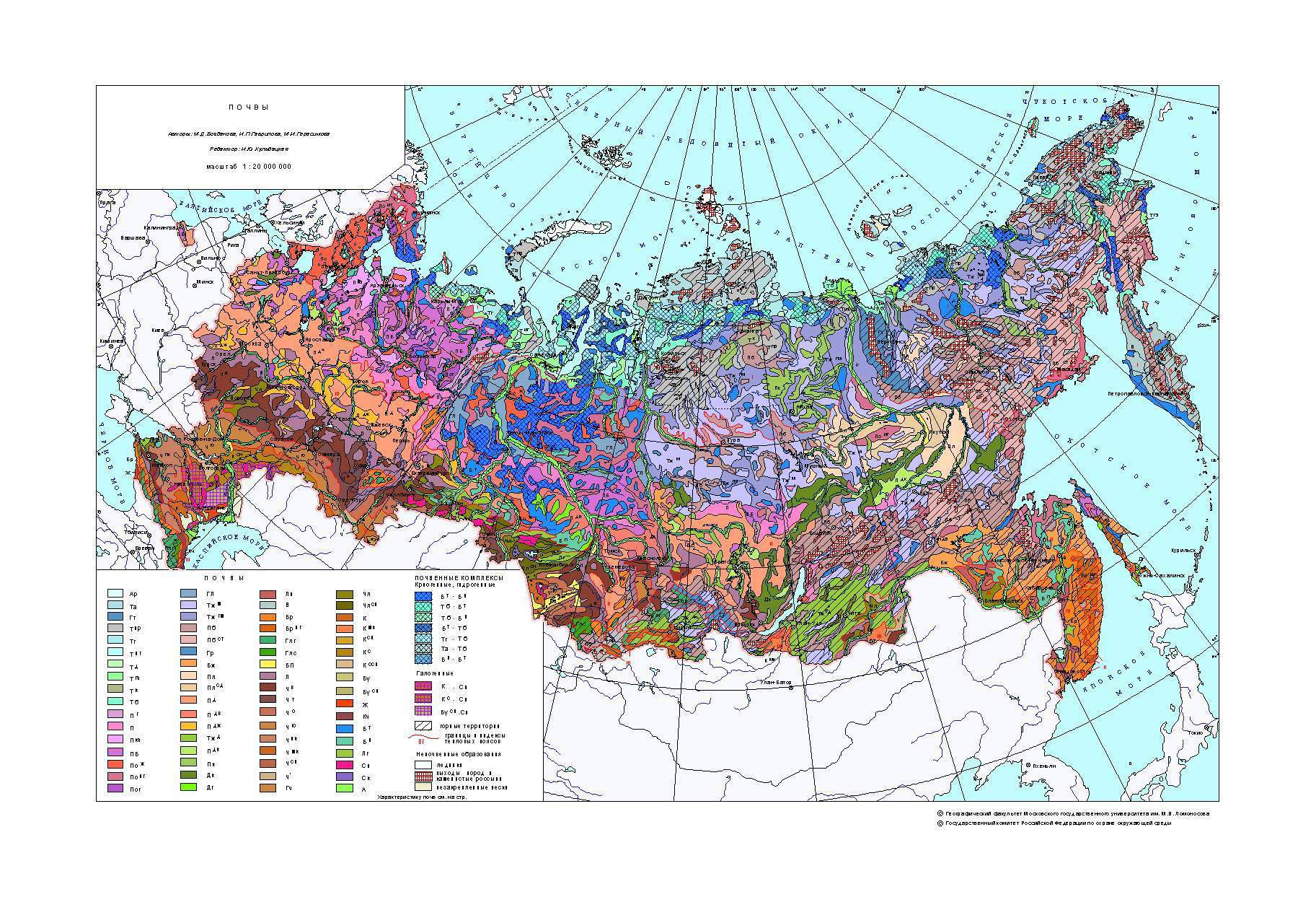
Method of quantitative background can be represented by the same method. It is used for representing average annual precipitation or run-off volume per unit of areas, density and depth of relief partition, etc. The design of this method of representation is close to the method of quantitative background, but the richness of color or hatching intensity of the scale levels represents the index of growth.
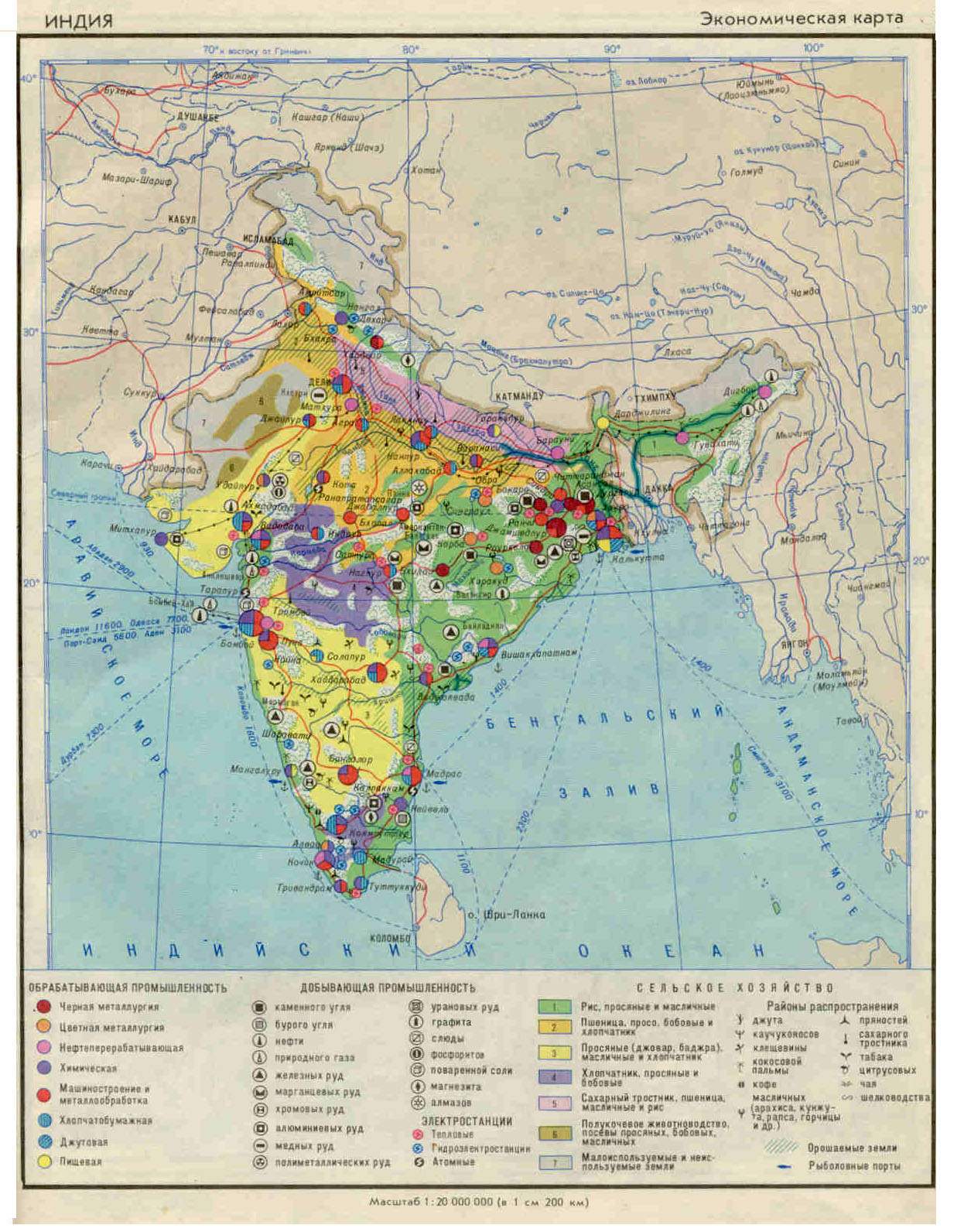
The most clear classifications are those that are based on one characteristic, for example, characteristic of the population according to nationality. Classifications using some characteristics that are consequent at the different stages of gradation are also very clear. For example on the soils maps at first rock soils and plain soils are marked out and then in each type minor types are distinguished. Synthetic classification is more complicated that have in its structure several characteristics, for example agricultural regions.
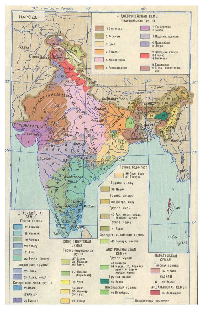
Borders of the districts that are distinguished according to the method of qualitative background are marked either in the process of field survey or aerial photography or on the basis of literary and cartographical sources. It's not very complicated to mark the border that is fixed at the site, for example political-administrative; but its more complicated if the change of the events is gradual. For instance when performing cartography of peoples' distribution where as a rule there is no distinct border because linear borders can hide the course of changes in ethnic structure of the population. In order to represent these transition zone we can use checked or stripped coloring method. By varying the width of strips or sizes of checks its possible to represent different proportions in the areas of overlapping.
When selecting colors we should keep it in our mind the types of cartographical event that are close in the qualitative relation must have similar colors. Some standard scales of coloring are developed for some maps, for example, geological ones.
Two color backgrounds cannot be overlapped, but it is possible to unite two or even three different systems of quantitative background with the help of combining background and hatching. This can be clearly seen on the soil maps.