Mapping runnability accurately is very important for route choice and overall fairness of competition. Much time can be gained, or lost, if the runnability is not what the orienteer expected.
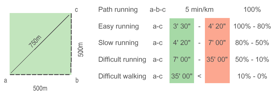
The square represents a homogeneous plantation bordered by a path. The diagonal route a-c (707 m) through the forest will be quicker than the path route a-b-c (1000m) around the forest edge depending on the forest's runnability. The green column demonstrates the best running time; the red one the worst time within each classification. It is easy to calculate that it does not pay to run through slow running forest (20 % green) if the speed is reduced to 70 %.