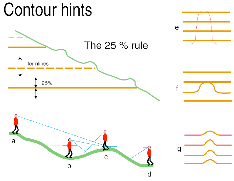
Contours are allowed to deviate by up to 25% of the contour interval (1.25m for 5m contours) to show important topographical features. Any terrain features terrain less than 1.25m cannot be represented accurately by contours. Orienteering map contours are used primarily to show the shape of the terrain, they are not used to show accurately elevation.
a - d: The diagram demonstrates that the appearance of the terrain can seem different depending on from where it is viewed.
e - g: Very often a correction to contour feature is localized from the fieldworkers perspective when it should be considered over a wider
area. The result is often like f when it should be like g.