XII. 20. |
Sárközy Zsófia 2nd year BSc student of cartography was elected the orienteer of the year by the Hungarian Orienteering Federation. |
||||||||||||||
XII. 12. |
|||||||||||||||
XII. 3. |
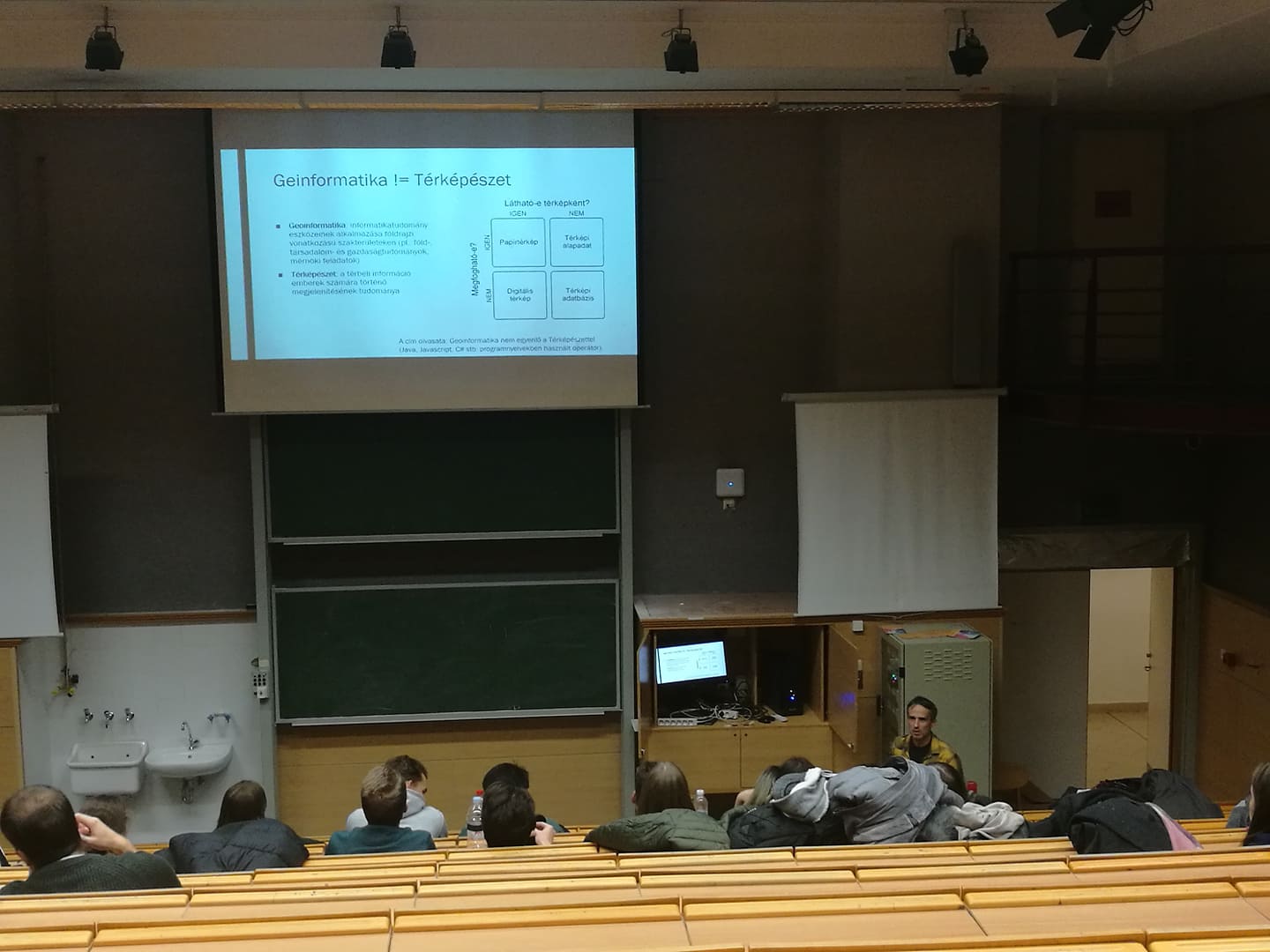
Albert Gáspár gave an introductory presentation on the cartographic and geoinformatic specialization to the first year BSc students of earth sciences to help their choice of further studies. |
||||||||||||||
XII. 1-4. |
Jesús Reyes associate professor visited Alcalá de Henares University and the Spanish National Geographic Institute. He was invited to participate as the chair in a PhD defence, „Adquisición integral de la Competencia Matemática: una propuesta didáctica interdisciplinar” by Elena Zapatero (second secretary of the Cartography Commission of the Spanish Association of Cartography, Photogrammetry and Remote Sensing). In the National Geographic Institute, he had a talk with Andrés Arístegui, vice-president of the ICA, Javier González Mantesanz, responsible for the geodetic and cartographic activity of the institute, and Pilar Sánchez-Ortiz, secretary general of the Spanish Association of Cartography, Photogrammetry and Remote Sensing. The main topic of the talks was the publication of a book that would contain a selection of the drawings submitted to the last two Barbara Petchenik international competitions, which is to be published in September 2020. |
||||||||||||||
XI. 26. |
Open Day at the Faculty of Informatics The department was represented by Buga László and Márton Mátyás at the inaugural lecture „Gravitational research in the year of Eötvös Centenary” by Völgyesi Lajos, corresponding member of the Academy. |
||||||||||||||
XI. 21. |
Tea afternoon of cartographers in the library of the Faculty of Informatics |
||||||||||||||
XI. 20. |
Prof. Dr. Enkeleida Goga Beqiraj (Department of Earth Sciences, Faculty of Geology and Mining, Polytechnic University of Tirana) visited the department. The topic was to work out an Erasmus+ credit mobility project that would run for four semesters from 2020. The project would be built around the theme of geoinformation in earth sciences and would include the mobility of students and teachers. Departmental coordinator: Albert Gáspár. |
||||||||||||||
XI. 9-10. |
Whirls of Earth Sciences exhibition in the Museum of Natural Sciences. The department was among the exhibitors, Albert Gáspár gave a lecture, "Maps in earth sciences". Participants in oganizing and arranging the programmes of the department:: Pál Márton, Kiss Veronika Flóra, Eszényi Krisztián, Varga Csaba Gergely, Lenkefi Botond, Gerzsenyi Dávid, Zelenka Balázs, Veres Kinga, Vörös Réka. At least 500 visitors came to the stand of the department in two days. The new types of games such as the polygonic globe of the Earth, Moon and the sky were most popular (the objects were produced by Kerkovits Krisztián on the idea of Albert Gáspár). |
||||||||||||||
XI. 8. |
Török Zsolt Győző, associate professor of the department gave a lecture in Marosvásárhely (Târgu Mureș, Romania) at a November event of Speaking Books. Topics: maps in the renaissance, what the collectors and users were looking for, purchases of 18–19th century maps by Teleki Sámuel, changing use of maps, use of maps in the 21st century, exciting experiments in map use. |
||||||||||||||
XI. 4-5. |
Zentai László gave two papers at the University of Wuhan, China: Orienteering map: a special, but perfect example of user-driven cartography; Hungarian experiences on atlases: school atlases, Hungarian National Atlas |
||||||||||||||
X. 23-25. |
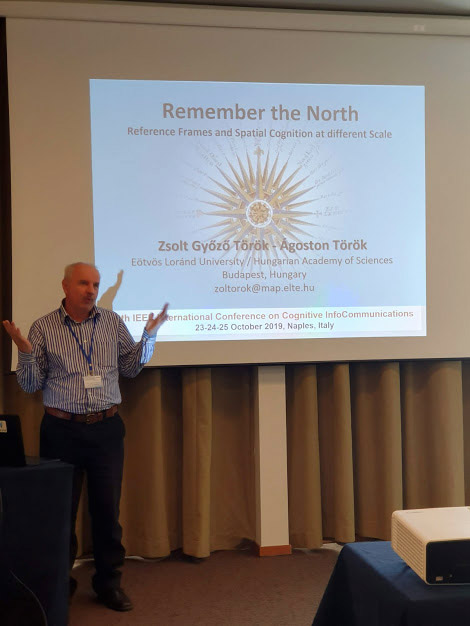
Török Zsolt Győző associate professor participated in the 10th IEEE International Conference on Cognitive Infocommunications conference in Naples. He gave a paper, „Remember the North: Reference Frames and Spatial Cognition at Different Scale” (co-author: Török Ágoston). |
||||||||||||||
X. 11. |
ELTEfeszt 2019, choice of career festival of the university in Budapest. Albert Gáspár gave a paper, Cartography based on geoinformatics: from field work to application development. At the stand of the department students and PhD students were “on duty” (Pál Márton, Vörös Fanni, Gerzsenyi Dávid, Varga Csaba), Kerkovits Krisztián and Kiss Veronika helped the preparation. |
||||||||||||||
X. 3-5. |
Jesus Reyes participated in the IGU’s 2nd International Congress on Geographical Education event in Eskişehir, Turkey. He gave a paper, Tradition and innovation teaching map use in Hungarian schools. |
||||||||||||||
X. 4. |
Irás Krisztina participated in the GDI-ESRI users conference in Budapest, where she presented a poster, Develop your GIS skills in this way! The effectiveness of project work in teaching geoinformatics. |
||||||||||||||
IX. 27. |
The Night of Researchers. Programmes offered by the Department: Make your own globe! Find your way in the Campus! Organizers and contributors: Gede Mátyás, Nemes Zoltán, Szekerka József, Veres Kinga (colleagues from the Department), Farkas-Németh Zoltán, Takáts Tünde, Varga Lola, Vörös Fanni, Vörös Réka (regular students and PhD students). |
||||||||||||||
IX. 23-27. |
15th European Geoparks Conference in Sevilla, Spain. The Department was represented by Pál Márton, a PhD student. He gave a paper, Digital cartography for the Bakony–Balaton UNESCO Global Geopark. |
||||||||||||||
IX. 21. |
The capital of sciences event (STEM Festival) at ELTE. Paper from he Department: Török Zsolt Győző: Oientation without or with a map? |
||||||||||||||
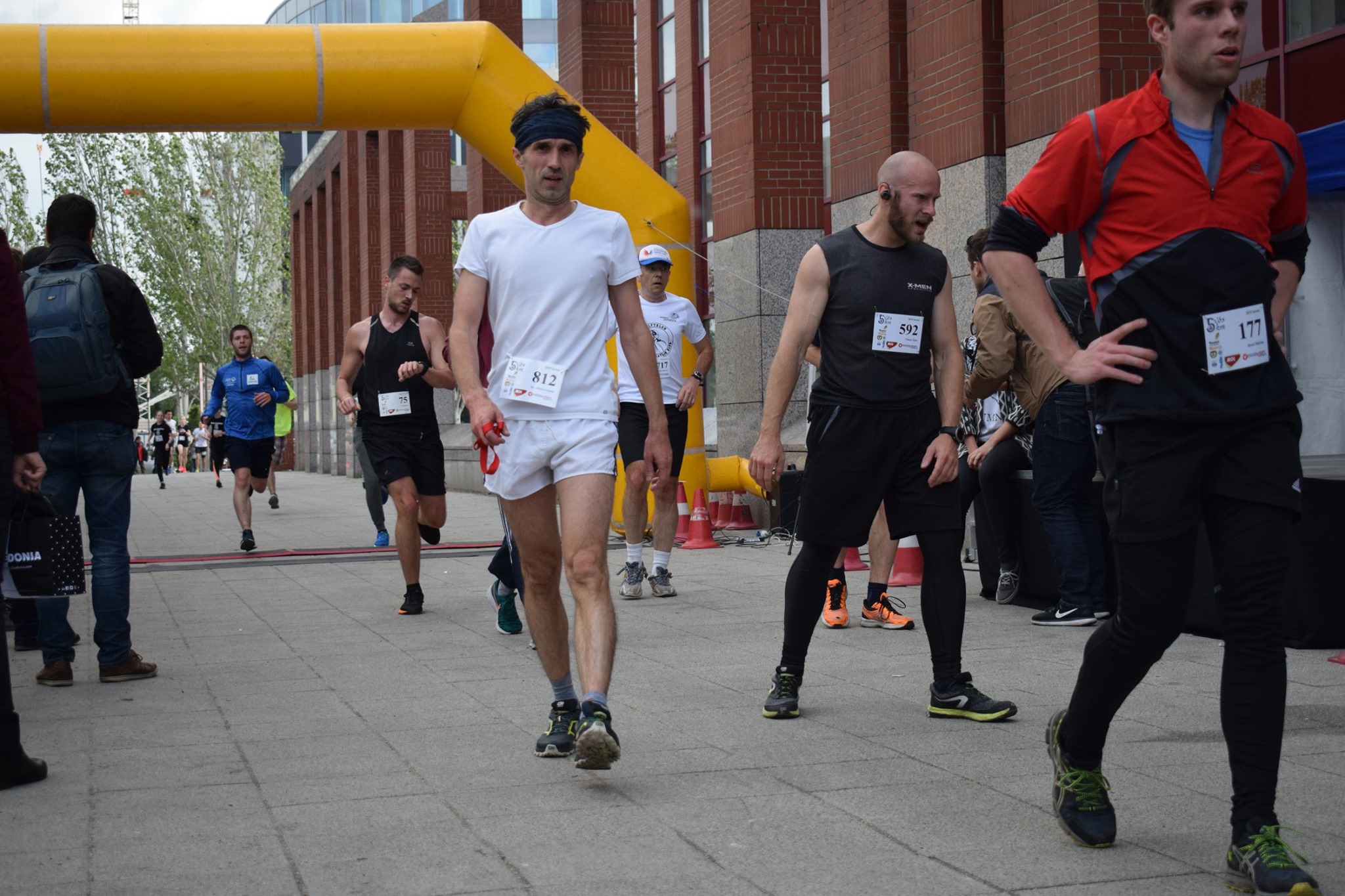
IX. 19. |
5vös 5 km race. Participants from the Department: Farkas-Németh Zoltán, Tóth András, Szabó Enikő, Lenkefi Botond, Balla Dániel, Gurály Attila, Nyulas L. Vince, Tóth Kornél (students); Pál Márton, Vörös Fanni (PhD students); Gede Mátyás, Irás Krisztina, Veres Kinga (teachers and other staff); Huszár László, Gregor Rita, Tolnai Gábor (former students). |
||||||||||||||
IX. 9-14. |
Erasmus mobility of teachers: Jesús Reyes gives a course on „Geovisualización y Cartografía” in the University of Santiago de Compostela in Lugos, Spain. |
||||||||||||||
IX. 9. |
The Thematic Programme of Excellence supported by the National Office of Research, Development, and Innovation (NKFIH) held its national press conference at ELTE. . Project presentations from the Department in the frame of the project High-reliability informatic solutions for specific applications of the Faculty of Informatics: Török Zsolt Győző (associate professor): "Spatial reference frame in cognitive visualization: the virtual tourist”, Takáts Tünde, MSc student of cartography (supervisor: Albert Gáspár, associate professor): Erosion protection and soil monitoring with precise relief modelling in the vineyards of Neszmély. |
||||||||||||||
IX. 3-4. |
Reguly 200 conference in the Hungarian Geographical Museum of Érd, opened by Klinghammer István. Papers from the Department: |
||||||||||||||
VIII. 28-31. |
Jesús Reyes gave a paper in the 2019 EUROGEO conference, „Hidden Geographies” in Ljubljana. His paper: „Erwin Raisz: a cartographer’s influence on school cartography”. |
||||||||||||||
VIII. 26. |
New secretary at the Department: Veres Kinga. |
||||||||||||||
VIII. 12-16. |
Kovács Béla gave a paper in the Division of Natural Sciences at the 23rd Summer Academy in Szabadka (Subotica) |
||||||||||||||
VIII. 1- |
After Gercsák Gábor’s ending his commission, Jesús Reyes became the Vice-Dean of International Affairs and Projects at the Faculty of Informatics. |
||||||||||||||
VII. 15-20. |
International Cartographic Conference, Tokyo. Participants from the Department: Albert Gáspár, Gede Mátyás, Jesus Reyes, Zentai László (teachers), Pál Márton, Vörös Fanni (graduating MSc students, prospective PhD students), Ashna Abdulrahman Kareem, Malak Alasli (SH PhD students).
The General Assembly of the ICA elected Zentai László vice-president of the organization for the period 2019–2023. The chairman of the commission Cartographic Heritage into the Digital became Gede Mátyás. ICA Scholarship support was awarded to Pál Márton, our graduating MSc student. |
||||||||||||||
VII. 15. |
ICC2019, Cartography for Specific Users pre-conference workshop in Tokyo. Jesus Reyes participated and contributed to editing the volume of proceedings. |
||||||||||||||
VII. 11. |
|||||||||||||||
VII. 10-12. |
ICC2019, pre-conference workshop. Geospatial and Cartographic Education – Contemporary Challenges and Opportunities, Bejing. Zentai László gives two lectures: Teaching orienteering maps: a perfect example of for user-driven cartography; Experiences of a new English language MSc programme in cartography |
||||||||||||||
VII. 4-6. |
Itinerary congress of the Hungarian Society of Surveying, Mapping and Remote Sensing in Békéscsaba. Pál Márton (recently obtained MSc in cartography) gives a paper in the junior section, Experimental usage of a high-precision GPS cartographic database in autonomous vehicle technology |
||||||||||||||
VI. 27-28. |
|||||||||||||||
VI. 19. |
MSc state exam of Stipendium Hungaricum students of cartography |
||||||||||||||
VI. 13-17. |
|||||||||||||||
VI. 11-12. |
State exam of Hungarian MSc students of caretography |
||||||||||||||
V. 31. |
Timár Gábor’s defence of Academic Doctor. One of the opponents was Márton Mátyás. |
||||||||||||||
V. 27-VI. 1. |
Gercsák Gábor has an Erasmus mobility week in Kolozsvár (Cluj-Napoca) at Babeș–Bolyai University. He held English–Hungarian translation courses for Hungarian students. |
||||||||||||||
V. 24. |
Török Zsolt Győző gave a lecture, Map reading or navigation? in the University of Debrecen, "ADA 2019" conference. The title of the conference series, Ada was named after the first female scientist of informatics. |
||||||||||||||
V. 23-24. |
10th GIS Conference and Exhibition in Debrecen. |
||||||||||||||
V. 22. |
|||||||||||||||
V. 16-18. |
Geomates 2019 conference in Pécs (International Congress on Geomathematics in Earth and Environmental Sciences). |
||||||||||||||
V. 8-10. |
Digital Approaches to Cartographic Heritage conference in Saloniki. Papers from the Department:
Section chairing: Gede Mátyás, Zentai László. |
||||||||||||||
V. 9. |
Török Zsolt Győző gave a paper, How does the Equator exist? – cases of existence of cartographic objects at the 3rd Dimension conference (Diversity and homogeneity in history, in society and environment) at the Faculty of Humanities of ELTE. |
||||||||||||||
V. 8. |
Neumann Day in the Faculty of Informaticsn. |
||||||||||||||
V. 7. |
Albert Gáspár gave a paper, Modelling of tension space based on point cloud in online environment in the Satellite Geodetic Observatory. |
||||||||||||||
IV. 25-V. 8. |
Three guest lecturers arrived at the Department within the Erasmus + ICM – Campus Mundi programme:
They gave classes as part of the elective course, „Cartographic Information Processing – School Cartography”. |
||||||||||||||
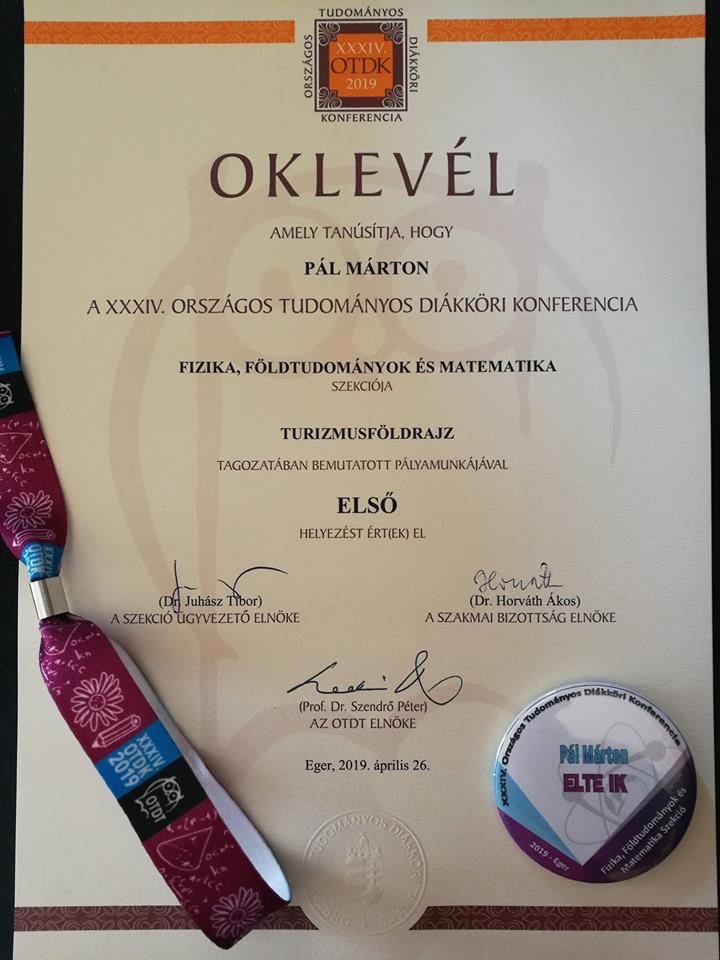
IV. 26. |
Pál Márton received first place in the Tourism Geography section of Physics–Geography–Mathematics at the National Student Research competition. Takáts Tünde reached the final in the section Application of Environmental and Earth Sciences. |
||||||||||||||
IV. 15-17. |
Jesús Reyes represented the Department at the Recontextualising Geography conference in London, organized by the IGU Committee on Geography Education. He gave a paper, Teaching Map Concepts in Elementary and Secondary Schools in Hungary. |
||||||||||||||
IV. 10. |
The students of the Czuczor Gergely Benedectine Secondary School visit the Lágymányos Campus and the Department. They visited the departmental library and map collection, got a presentation Cartography and geoinformatics, and tested the Google My Maps application. |
||||||||||||||
IV. 7-12. |
European Geosciences Union (EGU) conference in Vienna. Our presenters: Pál M., Albert G.: Managing the spatial variability of geosite assessment in the Balaton Uplands (Hungary)
|
||||||||||||||
| IV. 10. | The students of the Czuczor Gergely Benedectine Secondary School visit the Lágymányos Campus and the Department. They visited the departmental library and map collection, got a presentation Cartography and geoinformatics, and tested the Google My Maps application. | ||||||||||||||
| IV. 7-12. | The conference of European Geosciences Union (EGU) in Vienna. Our presenters (photos):
|
||||||||||||||
| IV. 6. | Geo Days in the Lurdy House. | ||||||||||||||
| IV. 5. | A one-hour live interview on the Beautiful Hungarian Map competition with Gercsák Gábor and Oláh Krisztina (PhD student) on Karc FM Radio. | ||||||||||||||
| III. 31.–IV.5. | Gede Mátyás takes part in the VESPA implementation workshop with Hargitai Henrik, planetologist. | ||||||||||||||
| III. 29. | Beautiful Hungarian Map 2019 - opening and announcement of results | ||||||||||||||
| III. 21. | Albert Gáspár gives a presentation, From the precise GPS measurements of dinosaurs of Iharkút to scientific modelling in the programme of the World Day of Surveyors and Geoinformatics. | ||||||||||||||
| III. 19. | Book presentation of the publication, 100 years of Hungarian Military Mapping 1919–2019 in the National Public Service University. The book was edited by Buga László, one of the consultants was Gercsák Gábor. The volume was reviewed by Zentai László. | ||||||||||||||
| III. 16–31. | Irás Krisztina, assistant professor, and Jesús Reyes, associate professor holds a 16-hour course in Rio de Janeiro within the framework of the Erasmus + ICM programme. Irás Krisztina gave a course, Data Driven Cartography in Niteroi, in the Institute of Geography at the Universidade Federal Fluminense, and Jesús Reyes had a course, Geovisualizaҫão e cartografia in Rio de Janeiro, in the GeoCart Laboratory of the Federal University. | ||||||||||||||
| III. 8. | Handover of MSc degrees | ||||||||||||||
| II. 12. | Contest of students: 100 years of Hungarian Military Mapping. The team of the Department finished at the 5th place. | ||||||||||||||
| II. 1.– | Zelenka Balázs, MSc students goes to the University of Olomouc in the Erasmus programme.
Arriving Erasmus students: Sigrid Loyning (Norway) and Jana Ambruzsova (Brno, Czechia) |
||||||||||||||
| I. 31. | Open Day in the Faculty of Informatics | ||||||||||||||
| I. 29. | Final exams of BSc students. | ||||||||||||||
| I. 18. | Open Day in the Faculty of Sciences |