| XII. 31. | Verebi Sándorné retires |
| XII. 17. | The Hungarian military cartography was awarded the title Hungarian Heritage. Prof. Klinghammer István gave the laudation address |
| XII. 16. | Departmental conference of undergraduate research. Presentation by Szabó Tímea |
| XII. 9. | Lázár Colloquium. Presentation by Gede Mátyás: Web geoinformatics 1 (MapServer, OpenLayers): practical classes of a subject to be renewed after February |
| XII. 2-6. | Zentai László gave lectures at the University of Philosophy in Nitra and at the Masaryk University of Brno, Slovakia. |
| XII. 1. | A new international professional organisation, the International Society for the History of the Map elected Török Zsolt president in London. |
| XI. 28. | |
| XI. 24-25. | The Executive Committee of the ICA had a joint meeting with commission chairs in Vienna. The department was represented by Jesus Reyes and Zentai László. |
| XI. 21-23. | 8th International Symposium on Location-Based Services in Vienna. Zsoldi Katalin, PhD student took part in the event. |
| XI. 21. | Lelkes György: Press conference on the new Dictionary of Hungarian Place-names. The maps in the dictionary were prepared by Faragó Imre. One of the presenters was Prof. Klinghammer István. |
| XI. 18. | Maria Isabel Castreghini de Freitas, teacher of the Universidade Estadual Paulista (Sao Paulo State University, Brazil) gave a presentation at the department titled “Tactile cartography In Brazil: Spatial Representation by Visually Impaired Students”.
|
| XI. 15. | Gede Mátyás participated with a poster at the conference, "Research of future Internet technologies and applications in Hungary". His poster was "3D models of old globes on the Internet". |
| XI. 11. | Lázár Colloquium: Kovács Béla: Practical presentation of geodetic and geoinformatic GPS instruments. |
| XI.10. | Török Zsolt represented the department in Vienna at the 50th anniversary symposium of the Austrian Cartographic Commission |
| XI. 10. | |
| X. 22-XI. 7. | Jesús Reyes visited Brazil on the invitation of the Department of Geography of the Espirito Santo State University, Vitoria. He gave classes to geography students with the title, "Alternative methods of thematic representations". He attended the conference, "7th Colloquium of Cartography", where he gave a paper, "Cartography and Children Commission”. On 31 October, in Niteroi, at the Fluminense Federal State, and on 1 November at the Rio de Janeiro Federal University he gave a paper, "Cartografia para Crianças: uma visao do mundo”. On 1 November, he visited the Sociedade Brasileira de Cartografia, Geodésia, Fotogrametria, e Sensoriamento Remoto, where he met Dr. José Carlos Penna de Vasconcellos, president of the society. He also met Dr. Paulo Márcio Leal de Menezes, vice-president of the ICA, head of the Laboratory of Cartography at the Rio de Janeiro Federal University. |
| X. 17-X. 24. | Elek István participated in the Fourth International Workshop on Advanced Computational Intelligence (IWACI2011) conference in Wuhan, China, organized by the IEEE Computational Intelligence Society, Huazhong University of Science and Technology and the Wuhan University of Science and Technology. He gave a paper, "Spatial Database for Digital Evolutionary Machines in an Artificial World without |
| X. 18. | The Division of Earth Sciences of the Hungarian Academy organized a ceremonial session to greet Klinghammer István on his 70th birthday. Zentai László gave a paper, "Cartography 2.0". |
| IX. 29. | Meeting of the ICA National Commission, election of the Hungarian members for 2011-2015 |
| IX. 28. | Zentai László gave a paper at the 32nd meeting of CEOS (Committee on Earth Observation Satellites) Working Group on Information Systems and Services) in Budapest. The title was The role of satellite images in the development of the Hungarian cartography and GIS |
| IX. 27-X. 9. | Gercsák Gábor participated in the International Conference on Landscape Conservation organized by the National Taiwan University. He gave a paper, "GIS for the Ipoly River Basin". |
| IX. 23. | Open day at the Faculty of Science: The night of researchers. Papers given by the members of the department: Global positioning system (GPS) in practice. Prepare your own globe! Zsoldi Katalin, PhD student worked for the programme, The world through 3D glasses in the Visualisation Centre of the Faculty of Science. Márton Mátyás represented the department at the Szeged University, when Prof. Dr. Keveiné Dr. Bárány Ilona was greeted on her resignation. José Flávio Morais Castro, a geography teacher from Pontifícia Universidade Católica de Minas Gerais (Belo Horizonte, Brazil) visited the department. |
| IX. 22. | |
| IX. 14. | Klinghammer István 70 years old - celebrations. |
| IX. 13-16. | |
IX-X. |
Erasmus students going abroad in the autumn semester: Ignácz Dóra, Kiszli Alexandra (Karlsruhe); Kőnig Ferenc (Bilbao) |
IX. |
Incoming Erasmus students: Elisabeth Talvistu (Tartu), Borja Gonzalez-Redondo Ares (Santiago de Compostela) |
IX. 5-9. |
Zsoldi Katalin, PhD student participated in the IAMG (International Association for Mathematical Geosciences) conference in Salzburg. Her poster, 3D methods in cartography was presented in the section 2D and 3D Geoinformatics and GIS. |
IX. 5. |
Departmental opening of the academic year in Pilismarót. Host: Elek István |
IX. 1. |
Irás Krisztina became a member of the department as assistant professor |
VIII. 23-25. |
International seminar, "Modern and attractive ways of teaching natural sciences" at the ELTE campus in Lágymányos. Klinghammer István ran a round-table discussion. Jesús Reyes gave a paper, Cartography in the public education. |
VII. 9-16. |
24th International Conference on the History of Cartography, Moscow. Török Zsolt gave a paper, Revisiting Rosselli's 'bottega': cosmography, art and printing in a Renaissance workshop. He chaired a session, which discussed the possible establishment of a new professional body, the International Society for the History of the Map. |
VII. 3-8. |
25th International Cartographic Conference and the general assembly of ICA in Paris |
VI. 30-VII. 1. |
Joint symposium of five commissions of the International Cartographical Association in Orléans, France. The local organisation was coordinated by Turczi Vanda, a PhD student of the department, associate of the local university. The volume of the symposium papers was edited by Zentai László and Jesús Reyes. |
VI. 29. |
|
VI. 24. |
The night of museums – in the National Széchényi Library, Kovács Béla gave presentations with the help of Szabó Csaba, MSc student (Don't get lost – interactivity with old and new positioning systems) |
VI. 22-24. |
BSc final exams |
VI. 20-21. |
|
VI. 17. |
|
VI. 14. |
A report film was made on cartography for the television show, University of Knowledge. Answers were given by Török Zsolt Győző, associate professor, and the degree thesis of Hillier Domonkos (2nd year MSc student) on the 1833 map of the Danube was shown. |
VI. 13-18. |
Radar remote sensing course in Szeged with the participation of the European Space Agency, Szeged University and the Geoinformatic and Geostatistical Commission of SZAB. Mészáros János, PhD student represented the department in the one-week course. |
VI. 10. |
|
VI. 9. |
Zentai László met William Cartwright, president of ICA, and Georg Gartner, vice-president of ICA in Vienna |
| VI. 6. | Darío César Sánchez, president of the Argentinean Geographical Society (Sociedad Argentina de Estudios Geográficos) gave a lecture "Social-territorial indicators and cartography" (Indicadores socioterritoriales y cartografía) at the department. |
VI. 2-4. |
Meeting of the University Network of the Central European Initiative (CEI UniNet) in Poznan. |
| V. 26. | Zentai László gave a lecture, "Expectations of scientists and scholars from the Bologna system" at the Zrínyi Miklós National Defense University in a conference, "The role of geoinformatics in administration, military and security".
President of the Division on Cartography: Márton Mátyás; Secretary: Gede Mátyás President of the History of Profession: Török Zsolt Member of the National Committee: Buga László (honorary associate professor) |
| V. 19-20. | The department was represented by Mészáros János, PhD student in Debrecen at the 2nd conference and exhibition, "The meeting of theory and practice". He gave a paper, "The projection system of the Water Directorate and its integration into GIS". |
| V. 18. | Prof. Miklós László, head of the UNESCO Department of Environmental Protection of the Technical University of Zólyom / Zvolen in Slovakia. He was a minister for environmental protection 1998-2006. |
| V. 12-13. | Zentai László participated in the German-Hungarian Higher Education Days in Karlsruhe |
| V. 12. | Georg Garter, professor of the Vienna Technical University, Vice-President of the ICA, and Michael Peterson, professor at the University of Omaha, president of the ICA Commission on Maps and Internet visited the department. At the Neumann Day of the Faculty, Georg Gartner was an invited lecturer. Jesús Reyes gave a paper on the TÁMOP project, "The informatics of large cartographic databases and thematic cartography". On the Neumann Day, Ungvári Zsuzsanna an MSc student of cartography was awarded the Eminent Student of the Faculty. Her consultant at the National Undergraduate Research Competition, Gede Mátyás received a certificate of merit. |
| V. 3-5. | Zentai László, head of the department visited the University of Tartu within an Erasmus monitoring project. He met Ülo Mander, head of department and Raivo Aunap associate professor. |
| IV. 29. | Lázár Colloquium: Presentations by Mészáros János and Zentai László
|
| IV. 28. | Three of our student participated in the 30th National Undergraduate Research Conference in Nyíregyháza, in the section Physics, Earth sciences and Mathematics. (positions in parentheses) Kirisics Judit: The present state of the reconstruction of Perczel's globe by the example of North America and the Northern Pacific Ocean. (7th) Ungvári Zsuzsanna: Making earth globe maps by digital projection transformation (3rd) Zsoldi Katalin: The golden age of Russian cartography (8th) |
| IV. 21. | Pápay Gyula, an outer member of the Academy, gave his inaugural lecture at the Academy |
| IV. 16-21. | Márton Mátyás gave classes in Kolozsvár / Cluj as an Erasmus exchange teacher |
| IV. 15. | ELTE GIS MeetUp 2011: paper from the department was given by Gede Mátyás (Google Maps / Earth samples). Students former and present students had papers: Hayth Balázs, Kirisics Judit, Strommer Domonkos. |
| IV. 6-9. | 6th Digital Approaches to Cartographic Heritage, an international workshop held in The Hague, had two papers from the department: Gede Mátyás (Digital Support for Globe Exhibitions) and Mészáros János (The georeferencing method of the 1:5000 scale Danube maps). |
| IV. 6. | Bartos-Elekes Zsombor, an Erasmus exchange teacher gave classes at the department
|
| IV. 3-8. | The European Geosciences Union had its general assembly of 2011. At its international conference, Mészáros János (PhD student) represented the department with a poster, "The Danube Cadastre map system and its georeferencing method". |
| IV. 1. | Kovács Béla became an assistant professor |
| III. 18-27. | Jesús Reyes held classes and lectures in Barcelona as an Erasmus exchange teacher, |
| III. 18. | Awards and opening of "Beautiful Hungarian Map 2010". A short meeting with Bartalos Gyula, a retired teacher of the Technical University of Pozsony / Bratislava. |
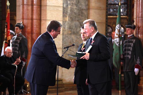
| III. 14. | Klinghammer István was awarded the Medium Cross (civilian division) of the Medal of the Republic of Hungary on the occasion of the national holiday of 15 March |
| III. 11. | Márton Mátyás defended his thesis at the Academy |
| III. 9. | Exhibition from the maps of the Department in the Károlyi Castle in Fehérvárcsurgó. The curator of the exhibition, "Peoples, languages, cartography" was Török Zsolt. |
| III. 3. | Zentai László represented the Department at the 2nd conference of HUNAGI in the Gellért Hotel. |
| II. 11. | Zentai László gave a paper, "Territorial disputes of China" at a conference, "China: the geopolitical super power of the 21st century?" organized by the Geopolitical Research Centre and the Vietnamese Cultural and Research Centre of the King Sigismund College. |
| II. 3-22. | Jesús Reyes participated in the 14th international meeting and fair, Informática in Havana, Cuba. He gave a paper, "Some tasks for data visualization in the MSC degree on cartography in Hungary" in the Geoinformatics section of the 7th International Conference on Geomatics, |
| II. 1. | Ana Martínez García, an Erasmus exchange student from Universitat de Catalunya, Barcelona, started writing her degree thesis at the Department |
| II.- | Outgoing Erasmus students: Gáncs Dániel (Universidad del Pais Vasco), Szabó Bence (Tartu) |
| I. 31. | Publication of the textbook Cartography and Geoinformatics - I by Eötvös Kiadó and edited by Klinghammer István. Authors: Faragó Imre, Gercsák Gábor, Horváth Ildikó, Klinghammer István, Kovács Béla, Pápay Gyula, Szekerka József. |
| I. 28. | Open Day of the Faculty of Science |
| I. 26. | Andoni Ochoa, a student from the Basque University defended his degree thesis "Monitoring the changes in Tabán park with GPS and GIS techniques".
Open Day of the Faculty of Informatics. Török Zsolt Győző gave a paper on cartography |
| I. 25. | Final exams of the 5-year cartography programme |
| I. 24. | Final exams of the BSc students |
| I. 19-21. | Török Zsolt Győző represented the Department to greet Prof. Manfred Buchroitner in Dresden on his 60th birthday |
| I. 14. | PhD defence by Kovács Béla |
| I. 8-11. | Zentai László visited the University of Ljubljana and gave a paper, ""Web 2.0 > Cartography 2.0" |