(digital facsimile)
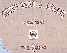
A DIGITAL FACSIMILE EDITION OF THE ATLAS EDITED IN 1945
BY THE INSTITUTE OF POLITICAL SCIENCES
OF THE COUNT PAUL TELEKI RESEARCH INSTITUTE
|
Constructed by: Prof.Dr. Rónai András | The text was read by: Szőkéné Rónai Klára |
Society of St.Steven - Püski Publishing House
1993

The facsimile versions of the maps were prepared by the staff of the Department of
Cartography, Eötvös Loránd University, Budapest, Hungary:
Head of department: dr. Klinghammer István,
Bakonyi Kálmán, dr. Márton Mátyás, Jesús Reyes, Vellai István, dr. Zentai László
Digital facsimile technique developed by: László Zentai

 Jump to the Homepage of Department of Cartography and Geoinformatics, Eötvös University, Budapest!