Maps: Entire Hungary (in one file)
Warning!
Maps of our web server were not published yet in a traditional paper form.
Only the non-profit use of these images are allowed.
Don't delete the author's name from the images!
Links to the maps of other Hungarian webservers are marked with:  .
.
Zentai László
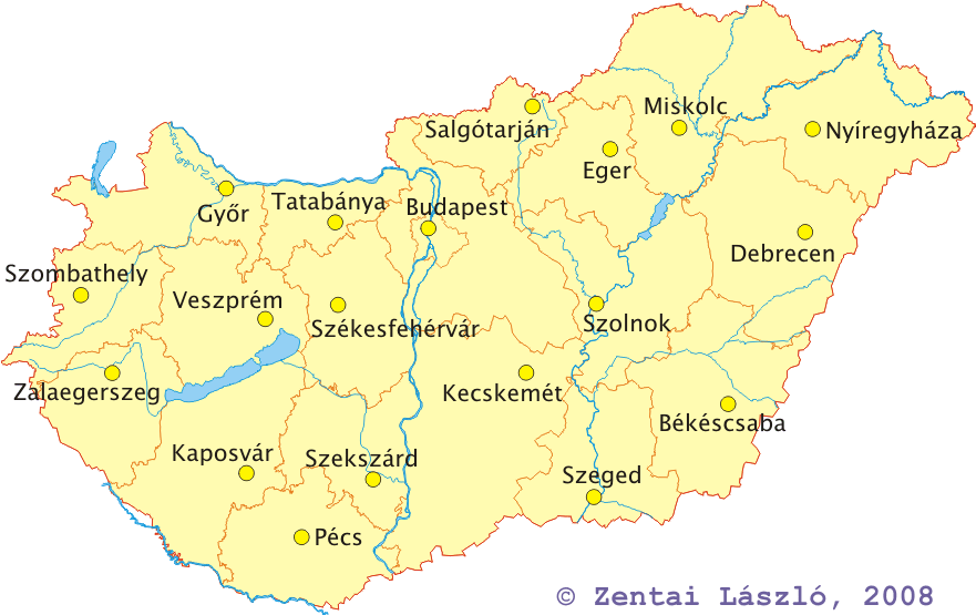
- Map of Hungary (forests, waters, county borders and capitals) - 842x542 pixels, 42274 bytes
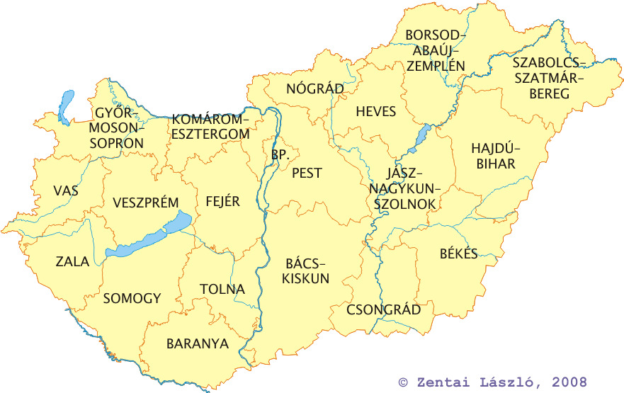
- Map of Hungary (waters, county borders and names) - 675x420 pixels, 24741 bytes
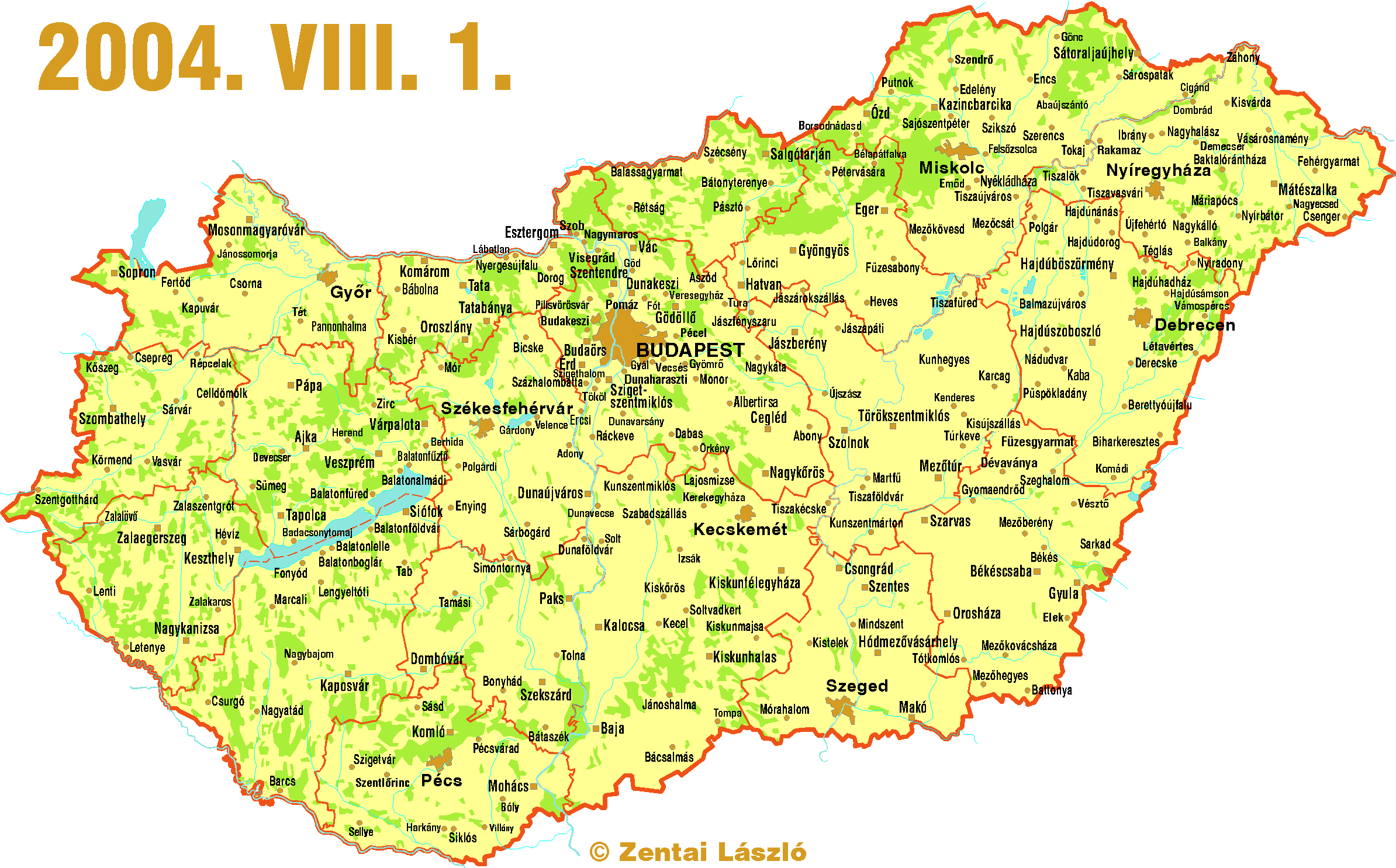
- Map of Hungary (forests, waters, county borders, all cities) - 2388x1486 pixels, 183852 bytes
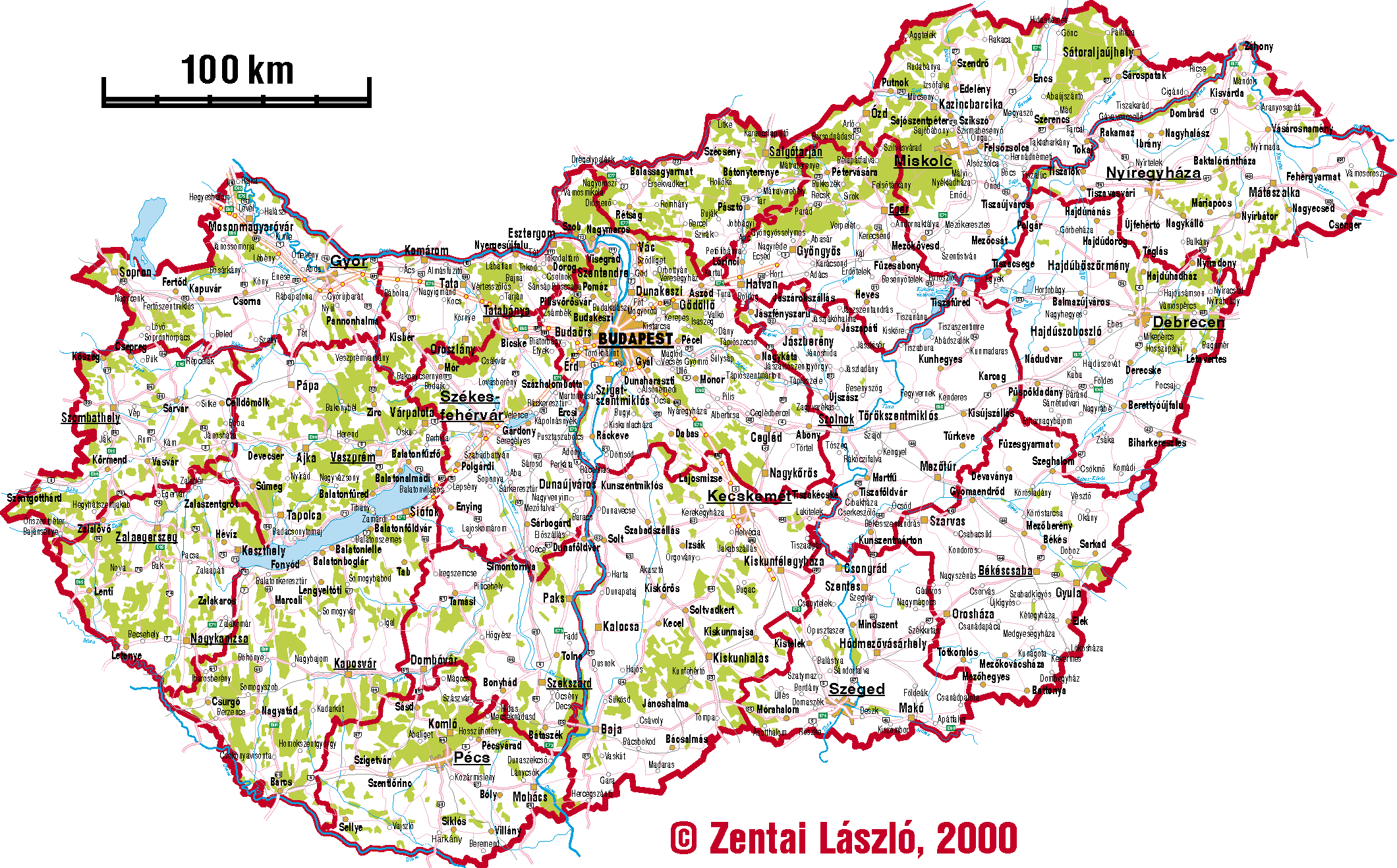
- Map of Hungary (forests, waters, county borders, all cities and largest villages, main road and railway network) - 2120x1315 pixels, 14 colour, 283021 bytes
- Airports of Hungary
- Hill shadings (in Hungarian)
- Internet network
- General map
- Telephon (Westel)
- Telephon (Matáv)
- Languages
 Back to the Map Collection!
Jump to the Homepage of Department of Cartography and Geoinformatics, Eötvös University, Budapest!