2. Undergraduate courses in cartography on the CET website
Back to the CET website
International Cartographic Association
www.icaci.org
 The
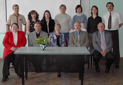
seminar "Cartographic Education and Training" was held on June
29, 2004 in Vilnius university. It was the second joint seminar, organized
by Commission on Theoretical Cartography (CTC), Commision Education and
Training (CET) and Cartographic Center of Vilnius university.
The
seminar "Cartographic Education and Training" was held on June
29, 2004 in Vilnius university. It was the second joint seminar, organized
by Commission on Theoretical Cartography (CTC), Commision Education and
Training (CET) and Cartographic Center of Vilnius university.
The agenda of the one-day meeting (which was held on the next day after
the annual meeting of Lithuanian cartographers) included two sessions
with 7 papers and poster session with 5 posters, and round table.
The organizers are going to publish results of joint seminar as a collection
of papers. The local organizer of the joint seminar was Giedre Beconyte.
Papers:
- László ZENTAI (Hungary): Internet Cartography Teaching Courses
- Alexander WOLODTSCHENKO (Germany): Cartosemiotics in Dresden
- Albinas PILIPAITIS: Professor v. Chomkis - Initiator of Training of cartographers in Lithuania
- Corné van ELZAKKER (The Netherlands): ITC Cartography education & web
- Lars BRODERSEN (Denmark): Communication through maps. Geocommunacation under the influence of an infrastructural environment
- Giedré BECONYTE-Alexander WOLODTSCHENKO: Cartosemiotics in schools
- Migle BERNOTAITE: GIS perspectives in secondary school geography
- Roma PETRAVICIUTE-Jurgita SPURAITE: Importance of Remote Sensing, GIS and (Carto)vizualization in cartographic teaching
- Linas BEVAINIS-Algimantas CESNULEVICIUS: Perception of cartographic images in Geography Learning at secondary school
- Jelena VAITKEVICIENE: Special Cartography in Master Programs at Vilnius University
- Arturas BAUTRENAS: Problems of Cartographic Education for the Disabled in Lithuania
In 2003 the main topic of the seminar was the cartosemiotics.
This year the main topic was the cartographic education and training.
The papers were followed by a discussion which was continued during the
dinner.
On the day of our departure we had a chance to visit the Lithuanian GIS
Center. They digitize the state topographic maps and update them. They
also distribute maps and cartogrpahic CD-ROMs. We visited the Cartographic
Section of the Lithuanian Geologic and Geographic Survey. The two national
institute was just integrated.
2. Undergraduate courses in cartography on the CET website
We started to collect the list of undergraduate courses
of the countries. We have already finished Europe (excluding Russia),
America (excluding USA), Australia and Oceania.
Africa and Asia are hopefully the forthcoming continents. We accept your
corrections and suggestions.
The International Cartographic Congress will be held in
A Coruña (Spain), 17-22 July 2005. The deadline of the paper
abstracts is 31 October 2004.
The conference website is: www.icc2005.org.
4. Joint seminar before ICC 2005, in Madrid
There will be a joint meeting of five ICA Commissions
(Cartography and Children, Education and Training, National and Regional
Atlases, Internet and Mapping, Visualization) just before the main conference:
6-8 July 2005.
The title is the Joint ICA Commissions Seminar on Teaching Atlas
and Map Use through the Internet.
The preliminary website of the seminar is available here.
Detailed information will be available continuously there.
5. Internet Cartography Teaching courses
The modules from the previous period are on the website
(Internet Cartography Teaching courses section).
An additional module (Toponymy) will be available soon.
I set up a mailing list to make the information
distribution much easier.
You can send a message to cet@lazarus.elte.hu
and your message will be sent to each "subscriber". All members
are subscribers, but you can unsubscribe automatically if you want.
It is allowed to send attachment to the list, but the size limit is 150
kB (practically your attachment cannot be larger then circa 100 kB).
The messages are automatically archived (depending on the actual network
speed the sent message may appear in the archive in some seconds). The
archive is available here: lazarus.elte.hu/lists/