17. how and why are bilingual maps produced?
Cultural criteria
-
Preservation of the cultural heritage of a people
-
Inhabitants of minority language areas also pay taxes, so they also have the right to see their own geographical names on the topographic maps.
Current trends
-
Increased bilingual representation or monolingual minority or regional names presentation.
-
Marginal information translation more available
Procedure
-
Delimitation of minority or regional language areas
-
Introduction of bilingual transitional periods on the map
-
Restoration of minority language names
-
Exclusive minority language rendering
-
Accompanied with bilingual marginal information rendering
Tools needed: language maps
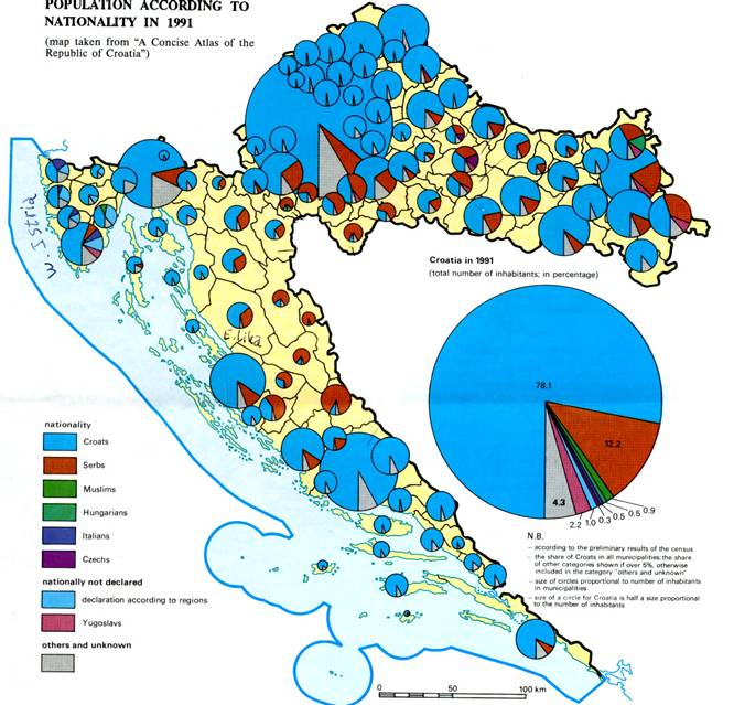
An example from a multilingual country: Croatia
Here you can see where the Serbian minority lives.
|
|
||
|
|
|
|
Home
|
Selfstudy
|
S8:
Multilingual
Areas, Minority Names