| Digitális
Könyvtár/
Library
Virtuális Térképtár/ Maps Oktatás/ Education Gyűjtőknek/Collectors Links |
 |
MAGYAR
TÉRKÉPTÖRTÉNET Hungarian Map History |
2003
Szerkesztő-editor: Dr. Török Zsolt |
|
|
| Digitális
Könyvtár/
Library
Virtuális Térképtár/ Maps Oktatás/ Education Gyűjtőknek/Collectors Links |
 |
MAGYAR
TÉRKÉPTÖRTÉNET Hungarian Map History |
2003
Szerkesztő-editor: Dr. Török Zsolt |
|
|
| IttHON
/ in Hungary |
News
in English |
KÜLFöldön/ Abroad | |
| Megjelent:
Fabó Beáta-Holló Szilvia:
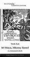
Török Zsolt:
|
 |
New books
Beáta Fabó -Szilvia Holló:
Zsolt Török:
|
|
| "summa cum laude"
Török Enikő:
|
Eötvös Loránd University, Faculty of Human Sciences,
Budapest, Múzeum krt. 4/a Témavezető/Professor: Dr. Bak Borbála |
'summa cum laude'
Discussion on Ph. D. thesis: Enikő Török: Samuel Mikoviny's engraved maps. |
|
| "A régi kínai térképek világa"
Kínai nyelvű előadás tolmácsolással. 2003. október 2., 17.00 |
Az Országos Széchényi Könyvtár
"A
tíz bambusz csarnoka" című kínai könyv és nyomdászattörténeti kiállításához
kapcsolódó előadás.
OSZK Budavári Palota F épület |
'The world of the old Chinese
maps'- Lecture to accompany the Chinese
book and print exhibition in Budapest.
Széchényi National Library |
FIG World Mapping Colloquium
Sydney and Canberra, Australia, September 19-27, 2003 The Colloquium will be held in conjunction with the International Map Collectors' Society and Mapping and Surveying History International and Australian Surveyors Congress. For more.. |
"A Tihanyi-félsziget a XVI-XVII. század
térképein"
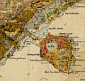 Megnyitják:
Klinghammer István rektor (ELTE) Brezsnyánszky Károly igazgató (MÁFI) |
Kiállítás a Tihanyi Bencés Apátság Galériájában.
Megnyitó: 2003. július 11. 17. óra Nyitva: 2003 08.17-ig, H-Szo: 9-18, V:11-18 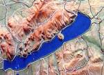
Lake Balaton/ Hungary |
'The peninsula of Tihany/
Lake Balaton on 16th and 17th century maps'
- special map exhibition from the collection of the Hungarian Geological Institute in the gallery of the Benedictine Abbey, Tihany opens on July 11! |
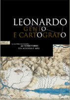
Leonardo da Vinci - La rappresentazione del territorio tra scienza ed arte - at Palazzo Communale, Arezzo, Italy, Leonardo's maps! June 21, 2003 - September 30, 2003 |
| A 20. Nemzetközi Kartográfiatörténeti Konferencián
(ICHC) részt vettek és előadással szerepeltek:
Írás Krisztina: Linschoten's India Orientalis and its Portuguese Cartographic Sources és Török Zsolt: The End of the Geographical Dreams: Samuel Mikoviny and the Beginnings of Scientific Mapping in Hungary |
2003. június 15-20.
Harvard University - Osher Map Library (Boston MA - Portland ME, USA)  |
From Hungary Ms. Krisztina Irás and Dr. Zsolt
Török attended the
20th International Conference on the History of Cartography in Boston/Portland, USA. Thank you Yolanda, Matthew, David and all ! |
Photos from Peter van der Krogt (as usual) |
| L'Ungheria nelle carte geografiche-
A térképkiállítás anyagát az Országos Széchényi Könyvtár Térképtárának anyagából válogatta: Dr. Plihál Katalin |
Biblioteca
Nazionale di Firenze
1-27 Aprile, 2003 |
'Hungary on old maps'
Exhibition from the Széchényi National Library, curated by Dr. Katalin Plihál, Head of the Map Collection |
|
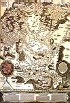
475 éves a Lázár-térkép Emlékülés és kiállítás az Országos Széchényi Könyvtárban Program |
2002. március 21. 11.30-15.15
Előadások 15.15 Kiállítások megnyitása |
March 21, 11.30 A.M.
475th Anniversary of the first printed map of Hungary, the Lazarus map (1528) see the map in detail Papers and exhibition Széchényi National Library, Budapest |
|
Török Zsolt -Map and Globe Maker |
|||
|
|
2001 |
|
 |
