Related Site: ICA Commission of the History of Cartography

 exploration, Discovery, cartography

 4th International Symposium of the ICA Commisssion on the History of Cartography

 Eötvös Loránd University, Budapest, Hungary, 28-29 June, 2012

VENUE 

The ICA Symposium will take place 
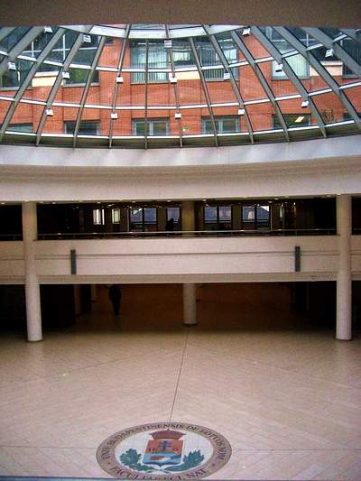
in the North Building, Lágymányos Campus,

Eötvös Loránd University, Budapest

(Postal address: H-1117 Budapest, Pázmány Péter sétány 1/a, Hungary).


Preliminary Programme (31 May, 2012)

June 27, 2012 Wednesday

14.00 'Cartography from three continents' special event

Evening: Ice Breaker Party for symposium participants!

June 28, 2012 Thursday

9.00 - 9.30 Opening of the Symposium

9.30 - 11.00 Session I Maps. Borders , Boundaries

Veres, Madalina (USA): Exploring and Defining Imperial Borders: Marking the Eastern Border of the Habsburg Monarchy in the second half of the eighteenth century

Handoyo, Sri (Indonesia): The brief history oh the boundary mapping between Indonesia and Timor-Leste

Demhardt, Imre Josef (USA): Gone to Texas! Land Speculators, Surveyors, and the Cadastral Mapping in the 19th Century Lone Star State

11.00 - 11.30 Coffee break

11.30 -13.00 Session II Thematic Mapping

Collier, Peter (UK): Edward Sabine and the “Magnetic Crusade”

Török, Zsolt – Hillier, Domonkos (Hungary): Exploring and Mapping the Danube between Buda and Pest: László Vörös' hydrographic and topographic map (1833)

Monmonier, Mark (USA): The Cartographic Discovery of the Great Lakes Snowbelts

13.00 - 14.00 Lunch break

14.00 -15.30 Session III Topographical Mapping

Liebenberg, Elri (South Africa): The “Major Jackson’s Transvaal and Natal Series” of the Anglo-Boer War (1899 – 1902): A cartobibliographic framework

Arnaud, Jean-Luc (France): The long life of a 1:200 000 map of Central Europe

Zentai, László (Hungary): Discovery of forested areas in topographic maps: development of orienteering maps

15.30 - 16.00 Coffee break

16.00 - 17. 30 Session IV Exploration and Mapping

Menezes, Paulo (Brasil): The General Map of the Republic of Brazil

De Maeyer, Philippe – De Coene, Karen (Belgium): Cartography in Congo

Hasegawa, Koji (Japan): Survey and cartography of Japan in the 19th century

18.30 Eötvös Loránd University Library visit, Map exhibiiton

June 29, 2012 Friday

9.00 - 10.30 Session V 19th Century Mapping in Europe

Altič, Mirela (Croatia): Exploring Along the Rome Meridian - Roger Boscovich and Production of the First Modern Map of the Papal States

Moser, Jana (Germany): Saxony as part of international collaboration – the mid-European meridian arc measurement since 1862

Christoph, Andreas (Germany): Media-related aspects of popularization – The geographical serials from the publishing houses of Friedrich Justin Bertuch

10.30-11.00 Coffee break

11.00-12.30 Sesssion VI Europe and the World

Feldmann, Hans-Uli (Switzerland): Charles Jacot-Guillarmod and his maps of the Himalaya regions (1914–1925)

Nemerkényi, Zsombor – Bartos-Elekes, Zsombor (Hungary/Romania): Explorers of Congo and Zambezi in the 19th Century and the Comparative Analysis of their Cartographical Works

Deák, Antal András (Hungary): The Mystery of a Mine Map

12.30 - 14.00 Lunch break

14.00 -15.30 Session VII Cartography and Names

Wu, Chia-Jung (ROC): Colonial mapping and naming of the Pacific Islands – case study of Orchid Island, Taiwan

Ormeling, Ferjan (The Netherlands): Name location on old maps

Rajakovic, Marina  Lapaine, Miljenko (Croatia) : Hungarian and Croatian Cartographers

15.30 - 16.00 Coffee break

16.00 - 17. 30 Session VIII Mapping People

Schunka, Alexander (Germany): The Raw and the Cooked – and the Recipe: Nineteenth-Century Map Descriptions as Historical Sources

Landais, Benjamin (France): Les communautés rurales, un acteur de la cartographie locale? Les premiers plans urbariaux du Banat (1772-1779)

Sorin, Avram (Romania): The historical evolution of Craiova municipality (Romania) resulted from the analysis of cartographic documents

POSTERS


Alsharrah, Saad (Australia): Use of Geographic Information Systems for Digitization and analysis of historical road maps of West YorkshireAntoš, Filip (Czeh Republic): Cartographic sources as a cultural heritage
Antoš, Filip (Czeh Republic): Cartographic sources as a cultural heritage
Depuydt, Joost (Belgium): Ambitious Antwerp (1850-1940)

Gercsák, Gábor – Márton, Mátyás (Hungary): Digital virtual restoration and reconstruction of a 150-year-old Hungarian globe
Isaksen, Leif (UK): The Practical Prognosticator - On the Use and Abuse of Ptolemy’s Geography

Jeney, János György (Hungary):  Comparison of the overall presentation of ethnic maps of Hungary made by German and Hungarian mapmakers between 1867 and 1920
Reyes, Jesus (Hungary): The first National Atlas of Cuba: Rediscovering the early  20th century country
Síkhegyi, Ferenc (Hungary): Geological Mapping in Central Europe in the 18th and early 19th century
Fodorean, Florin (Romania): Reconstructing the landscape: the second and the third military survey of Transylvania, modern cartography and discoveries from the former Roman Dacia

Evening: free (see optional social programmes in the Registration Form)

June 30, 2012 Saturday

The International Society for the History of the Map (ISHM) Symposium and Annual General Meetingmeeting

(Programme and online registration on the ISHM's website.)

Evening: Symposium Dinner (optional, see programmes)

June 31, 2012 Sunday

Post-symposium tour: Danube Bend (optional, for details see Tours/ programmes

27 June 2012, Pre-Symposium event

'Cartography from three continents'

- special event organized by the Department of Cartography and Geoinformatics, at Eötvös Loránd University (ELTE), in the frame of the 4th International Symposium on the History of Cartography of the International Cartographic Association (ICA)


Date: 27 June 2012, 2:00 PM

Place: ELTE Lagymányosi Campus, North Building, Pázmány Péter sétány 1/A, 7th floor, Room 7.59

Invited Speakers:

- Current Issues on Geographical Names: UNGEGN report to ICA - Ferjan Ormeling (The Netherlands),

- History of Cartography of South Africa - Elri Liebenberg (South Africa),

- Infrastructure of Spatial Data in Brazil - Paulo Menezes (Brazil)

See the event's leaflet with detailed information here

New:

ICA History of Cartography notice: Programme of ICA Symposium ● ISHM Meeting ● Publication of 2010 Proceedings ● ICC2013 ● ICA Commission Workshop is here!