(based on official statistics)

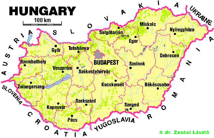
| Area: | 93 030.03 sq. km |
|---|---|
| Population (1995) | 10 245 677 |
| Percentage distribution | Males - 47.9 %; Females - 52.1 % |
| Capital (1995): | Budapest (1 930 014) |
| Number of counties (1995): | capitol (23 districts), 19 counties, 22 towns of county rank |
| Number of cities (1995) - see below! | 205 |
| Number of villages (1995): | 2916 |
| The highest peak | Kékes (1014 m) |
| The deepest point | to the south of Szeged (78 m) |
| Altitude above the sea level (below 200 metres) | 84 per cent |
| Altitude above the sea level (200 to 400 metres) | 14 per cent |
| Altitude above the sea level (above 400 metres) | 2 per cent |
| Largest lake | Balaton (598 sq. km) |
| Major rivers (Hungarian section) | Danube (417 km), Tisza (598 km), Rába (190 km), Zagyva (179 km) |
| Public railway lines | 7750 km |
| National public roads (1993) | 29963 km |
| Pipeline network | 6998 km |
| Permanently navigable waterways | 1396 km |
| Gross domestic product (1993) | 3500 US $ |
| Mean temperature (Budapest, 1993) | 11.3 °C |
| Amount of precipitation (Budapest, 1993) | 506 mm |
 Back to the Hungarian Orienteering HomePage