Very nice drawing. Good print. Most symbols seem to be according to ISSOM 2005


for many interesting things :-) )
SPRINT maps - Map Commission's comments
| Sprint final and Sprint qualification and sprint model (II)
"Showa no mori" - 1:5000, 2.5m. Very nice drawing. Good print. Most symbols seem to be according to ISSOM 2005 |
|
|
|
|
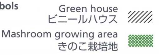
| Symbols not according to ISSOM2005 (small paths too wide black dashed lines, green house symbol, mushrooms symbol, ...) |
|
|
|
|
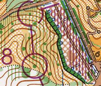
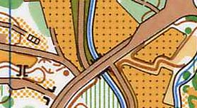
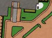
| Strange symbol - paved area with regular pattern of white dots between
the start and finish - probably a parking lot with scattered trees :-) |
|
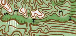
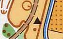
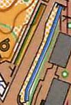
| Non-standard symbol used: 0.3 mm (or 0.50mm) black line with 0.18 mm short
black lines perpendicular to the black line close to the ends (extending
in both directions). Probably for old dams. |
|
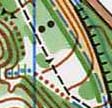
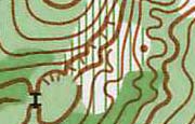
| Very short (too short) passable rock faces (2m). |
|
| Creative use of 529.1 (0.07mm, 0.10mm and 0.14mm and seems to be used for many interesting things :-) ) |
|
| 526.2 - 0.10mm (should be 0.07mm) |
|
| 414 - 0.10mm (shall be 0.07mm) |
|
| ISOM 209 Boulder cluster symbol used - not an ISSOM symbol |
|
| 208 - use of isolated triangles |
|
| 521.1 impassable wall symbol never used. Impassable cliff without tags
seems to have been used instead. |
|
| 106 - several objects with too wide base lines (0.45mm) |
|
| The widths of some bordering black lines are not according to the standard (304.1, 529.1) |
|