The scale, the equidistance and the symbols of the qualification
(Q: 1:4000/5 m) and final (F: 1:5000/2 m) maps are different.
Contour interval 5 meters is not allowed for a sprint map; 2 or 2.5 meters
shall be used.
Generally most symbol sizes and symbols are wrong. |
| The model event (1:10000/5 m) called as a sprint/middle distance
model, but there is no similarity to sprint events and terrains. |
|
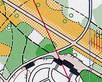
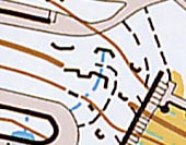
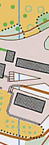
Qualification map problems
|
| The building on Q maps are black (except the large one on
the NW corner), on F maps are grey. |
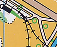
| Railway: this is not ISSOM symbol (it is similar to the ISOM2000 symbol,
but the thickness is wrong). |
|
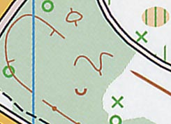
| Unusual contours. |
|
Different shades of brown are allowed [the (x+20)% rule], but not the
way that is done in this map.
|
|
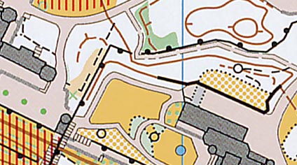
The barrier symbols (fence) are not thick enough.
Black path symbols are not allowed (only one is in the ISSOM).
|
|
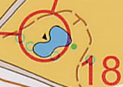
| Earth wall symbol is not used on sprint maps (this symbol is re-introduced
in the final standard, ISSOM2005 valid from April 2005). |
|
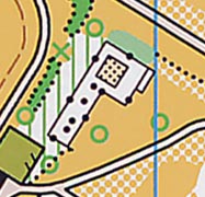
| The passable stone wall symbol is to be used only in non-urban terrains. |
|
|
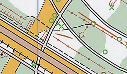
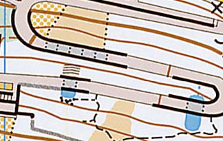
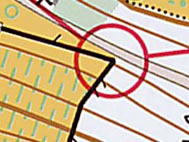
Final map problems
|
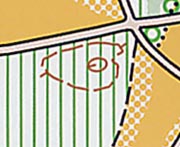
Black line with regularly spaced semicircles is not an ISSOM symbol.
Is this supposed to be passable rock faces with regularly spaced outcrops?
|
|
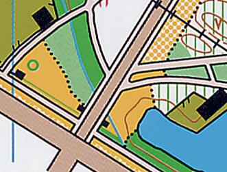
| Too thin passable rock face symbols, easy to confuse with path symbol. |
|
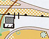
| The irregular black rectangle is not allowed to use as point symbol, this
is an area symbol (boulder field: a minimum of two triangles shall be used). |
|
| Mysterious symbol (gate?). |
|
| Mysterious brown lines crossing roads, contours have to be visible on
the roads. |
|
| North lines disappear under some features. |
|
| Fence mystery (if crossable - single tag - thin lines are used; if uncrossable
- double tags - thick lines are used). |
|
Contour lines mask out the outlines of the unpaved footpath symbol.
|
|