INDONESIA

countries - history of o-mapping
Suggestions, amendments warmly welcome: László Zentai - editor
countries - history of o-mapping
Suggestions, amendments warmly welcome: László Zentai - editor
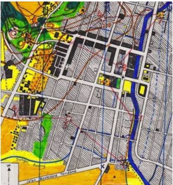
The first orienteering map in Indonesia: TONDANO O Map. The map has drawn by hand by Agnes T. Moningkey, Julian Ch. Manoppo, Jerry Watulingas, Sutriono Sukadi and Richard Kumaunang. The map has used in 2nd Manguni Orienteering Games 2001 at 10th November 2001 and held in Tondano City, North Sulawesi Province. The map scale was 1:10,000 and contour interval was 5 m. The base map was government topographic map with scale 1:50,000 and contour interval was 25 m.
sent by Julian Ch. Manoppo, 2012