History of orienteering maps by countries
ESTONIA

countries - history of o-mapping
Suggestions, amendments warmly welcome: László Zentai - editor


38.gif - 410817 Bytes
Map and course of the first o-competition in Estonia, 19.06.1926 in Pirita (9km from the center of capital Tallinn)

7e.gif - 131393 Bytes
1:21000, contour interval 14ft. Based on reprint (translated to Estonian) of Russian topomap. Original 2 color. O-map 1997 from same area

77.jpg - 188076 Bytes
Map and course of the first Estonian championship 27.09.1959 in Nelijärve (50km east from Tallinn), 1:50 000, based on agricultural map

qr.jpg - 405221 Bytes
Same area on 1:50 000 topographic map 1999

br.gif - 104701 Bytes
Part of this on o-map 1999

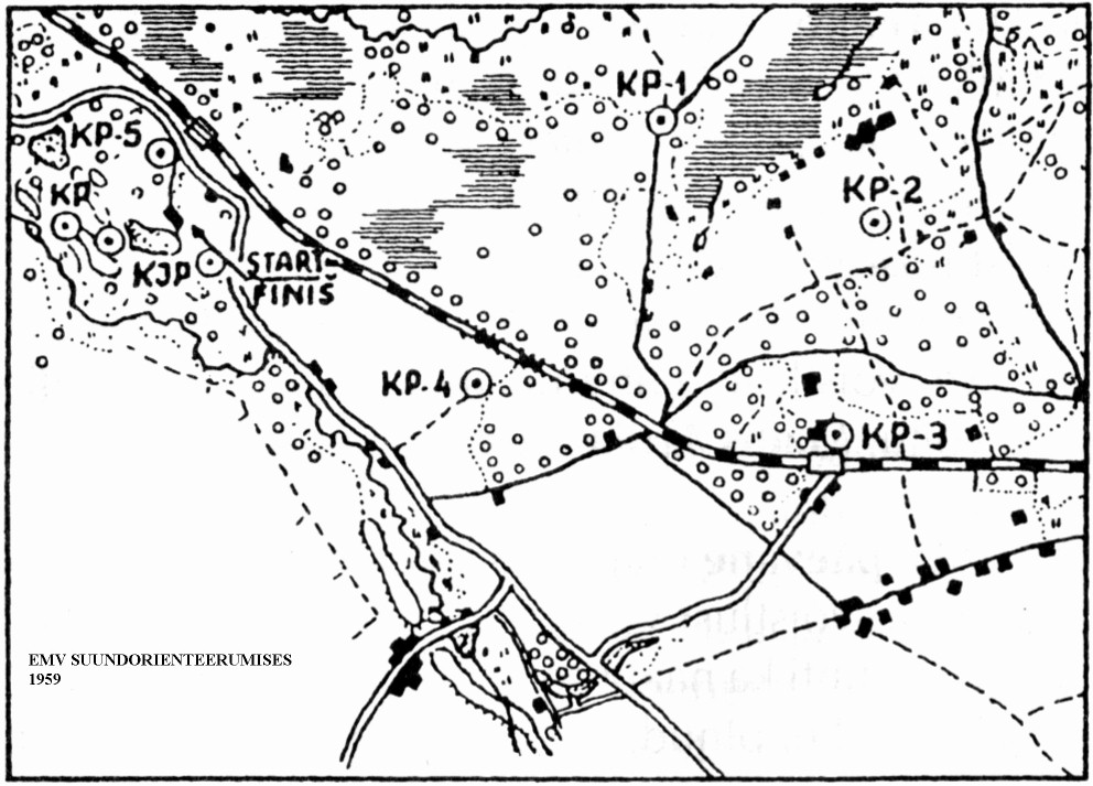
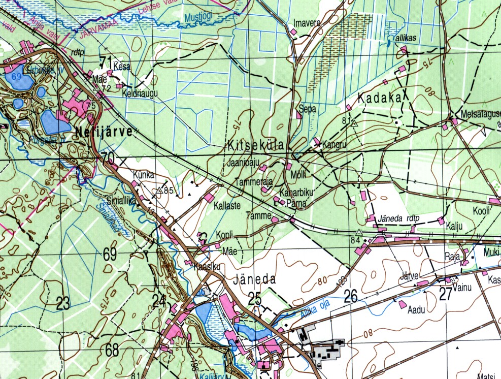
Andres Käär, Map Committee of Estonian OF (2001)