|
1
|
|
|
2
|
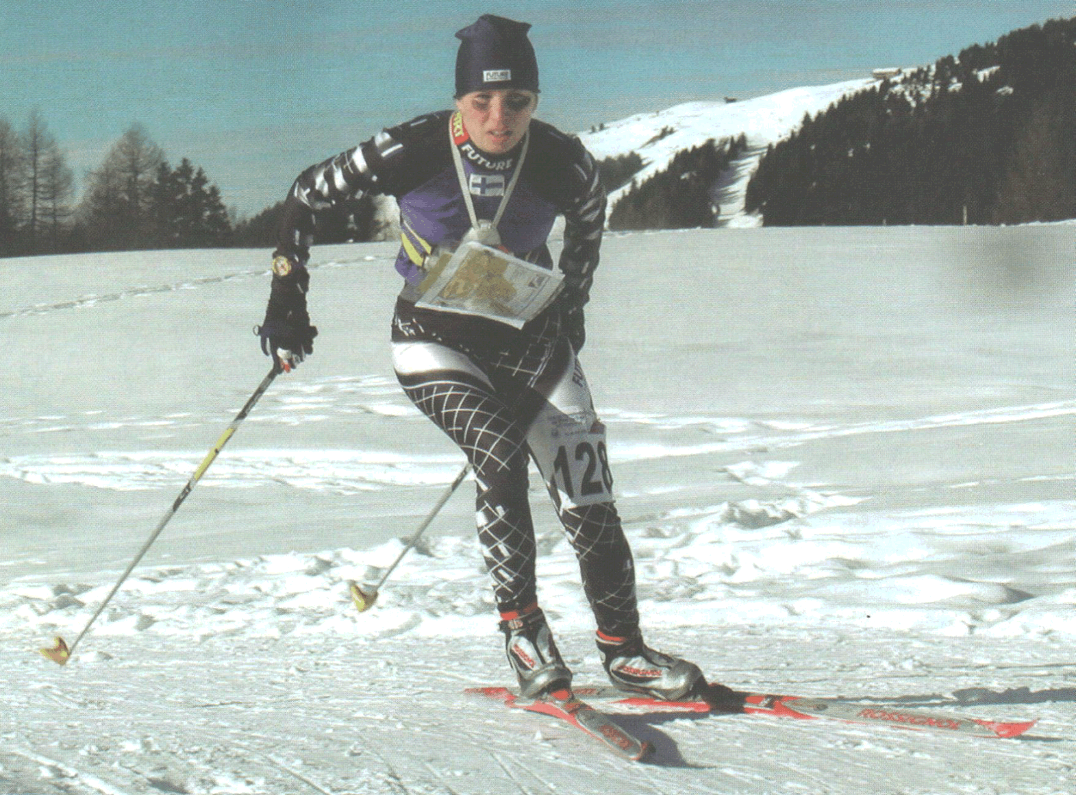
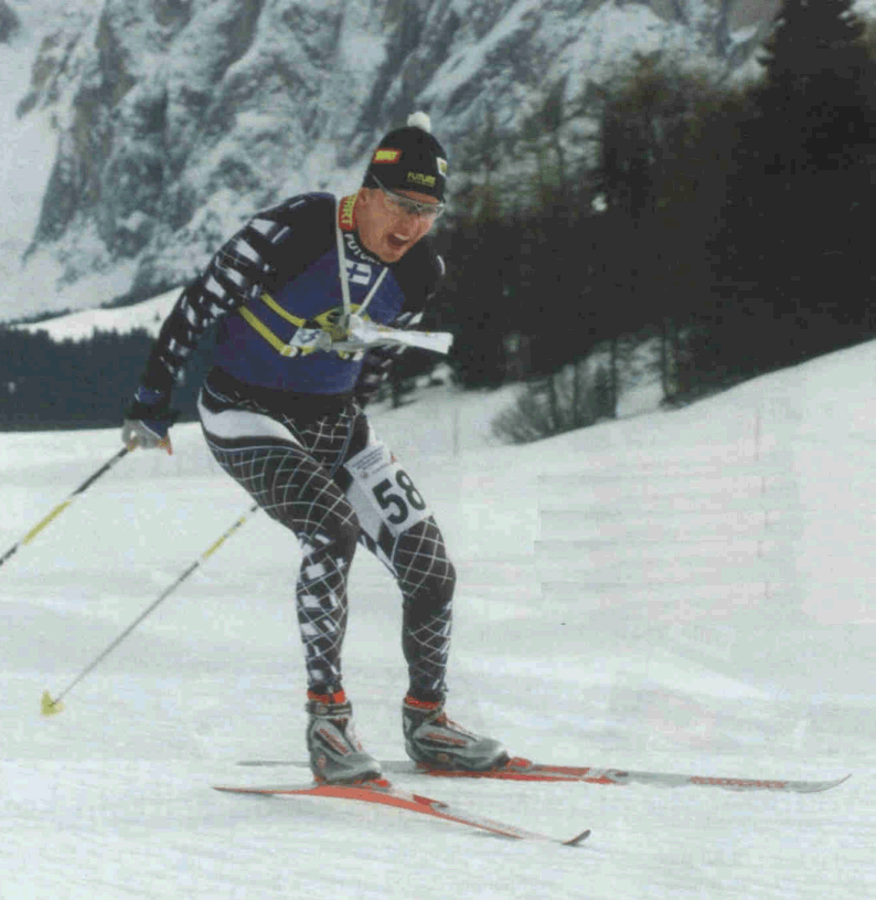
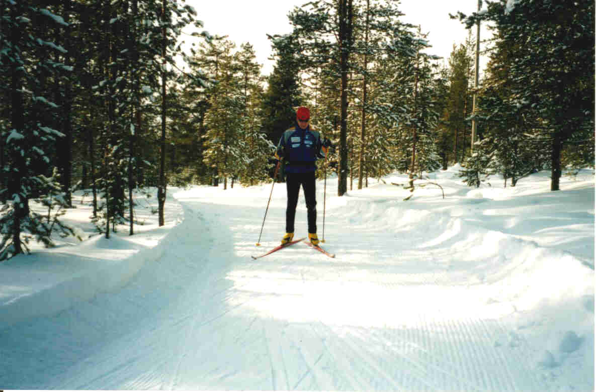
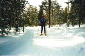
- DEFINITION
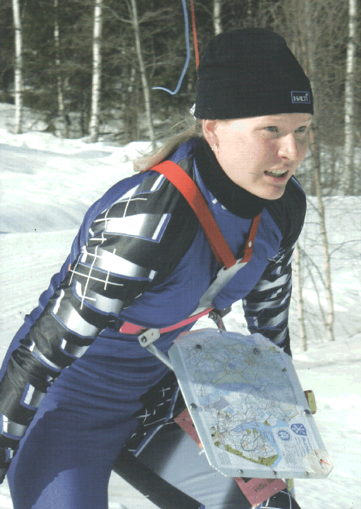
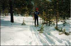
- An elite level ski-orienteer
- needs excellent skiing and
- map reading skills - and
- the ability to combine
- those two.
- The athlete has to take
- hundreds of route choice
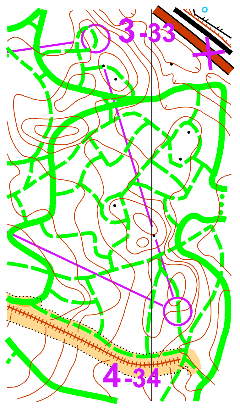
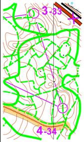
- decisions at high speed
- during every race.
|
|
3
|
- DEFINITION
- The route choice is made
- on the basis of the quality
- of the ski tracks, gradient
- and distance, all of which
- can be read from the map.
|
|
4
|
- EQUIPMENT
- - skiing equipment:
- - racing skis
- - boots, bindings
- - ski poles
- - map holder attached
- to the chest
- - map, compass
- - control card
|
|
5
|
- New Specification 2002
- The proposal by work group Liikari-Varis-Jokelainen Winter 2002
- Discussion in IOF Ski-O and Map Commissions Spring 2002
- Approved in IOF Ski-O and Map Commissions Autumn 2002
|
|
6
|
- Scales
- Classic 1:15 000
- Middle and relay 1:15 000 or
1:10 000
- Short 1:10 000
- Sprint 1:5 000 or 1:10 000
- In special cases in IOF events, the organiser and the
- IOF Event Advisor may decide on other map scales.
|
|
7
|
- Scale Track symbols Other symbols
- 1:15 000 as specified in this as specified in this
- presentation presentation
- 1:10 000 as specified in this 1.5 times larger than
- presentation in 1:15 000
- (same as in 1:15 000)
- 1:5 000 1.5 times larger than 1.5 times larger than
- in 1:15 000/1:10 000 in 1:15 000
- (same as in 1:10 000)
|
|
8
|
- 1. Upper purple:
- Control numbers and control codes, out-of-bounds areas, sanded or
snowless roads and the start symbol as well as focus point when
necessary
- 2. Black
- 3. Brown
- 4. Upper green (PMS 354): tracks
- 5. Lower purple: control points and lines between them
- 6. Blue
- 7. Lower green (PMS 361): all other green symbols except tracks
- 8. Yellow
|
|
9
|
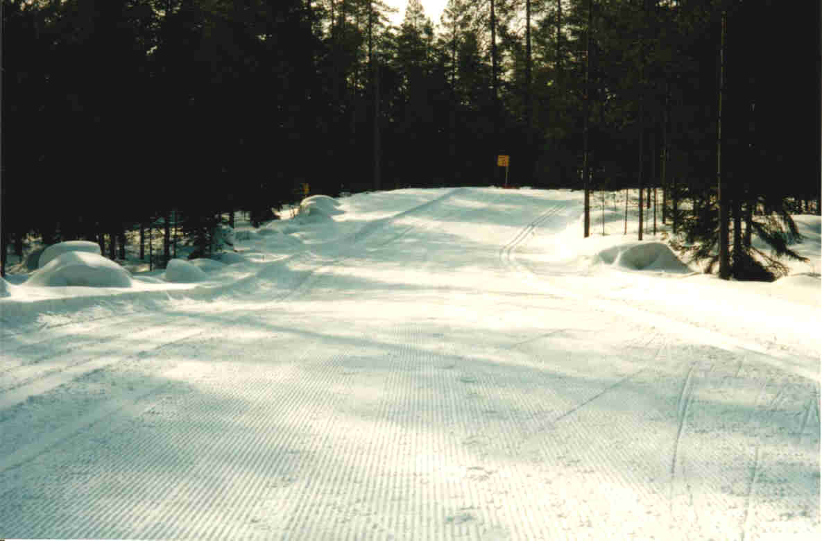
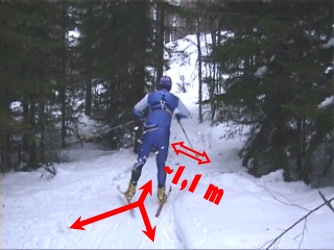
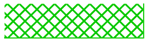
- 801 Very wide track >3 m
- Very fast, wide ski tracks in ski centres,
- made with a ski trail groomer or a track leveller.
- Continuous line 0.85 mm, upper green
|
|
10
|
- 802 Wide track 1.5-3 m
- A fast, skateable track made by a snow mobile, width usually 2-3 m.
- Skateable tracks rougher and
softer than the wide
- skateable tracks in the area.
- Continuous line, 0.65 mm, upper green
|
|
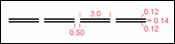
11
|
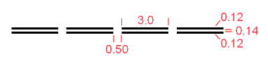
- 803 Track 0.8-1.5 m
- A good track made by a snow mobile, usually 1-1.5 m wide. In steep
- slopes, tracks may be made wider to reduce widening during competition.
- Dashed line (3.0/0.5 mm), width 0.5 mm, upper green
|
|
12
|
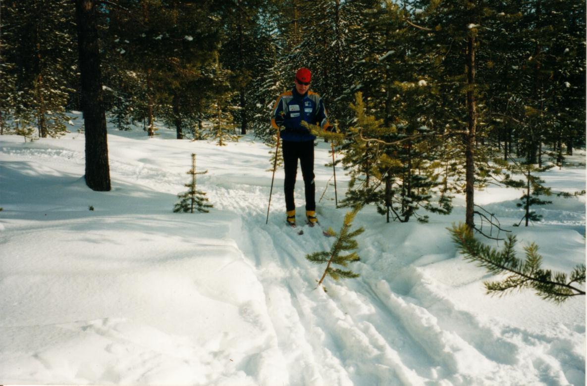
- 804 Track, slow 0.8-1.0 m
- A rough, slow track with little snow or some brushwood. This symbol is
not
- used in steep slopes, if the width of the track allows using herringbone
- steps for uphill, or snow plowing technique for slowing and stopping.
- In order to clarify a junction, the beginning of a slow track
- is drawn with a short line.
- Dotted line (diameter 0.7 mm, gap 1.3 mm), upper green
|
|
13
|
- Road symbols
- 805 Road covered with snow
- Snowploughed, skiable roads are drawn with a normal road symbol but
wider. 0.7 mm, black
- 806 Sanded or snowless road
- A road on the map which is sanded or snowless
- during the competition. A chain of V-marks
- across the road symbol show that the road is not
- skiable. Height 3.0 mm, upper purple.
- 807 Unploughed road
- A road which is not opened for traffic, no skiable
- track. (The snow has not been removed) Black.
- 809 Forbidden route
- The symbol 711 Forbidden route is drawn in a
- bigger size in a ski-O map so that it is more
- clearly visible in the track network.
- Length of the lines 3.5 mm.
|
|
14
|
- 808 Prepared area
- Alpine skiing slopes and other areas which are wide, skiable and hard.
- The boundaries of prepared areas are shown with a narrow green line
- (0.13 mm) so every edge can be read clearly.
- Lines 0.2 mm, gap 0.8 mm, angle 45O, upper green.
|
|
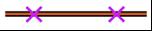
15
|
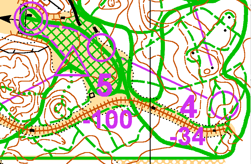
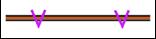
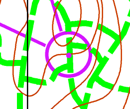
- 810 Control point and focus point
- The focus point (i.e. the point in the centre of a
- control circle) can be used when it is necessary to
- clarify the exact position of a control for instance in
- a dense track network. In ski-orienteering a control
- is preferably placed in one track only, not in
- crossings or junctions. A focus point helps specify
- the exact track where a control is situated.
- Colours: control point: lower purple, focus point:
- upper purple
- Diameter of control circles 5.5 6.0 mm (same in all
- scales), width of line 0.5 mm, diameter of focus
- point 0.65 mm
- 811 Control number and control code
- Code numbers for controls are placed either next to
- control numbers on the terrain area of a map or on a
- separate control code list.
|
|
16
|
- 812 Equipment deposit
- Colour: upper purple
- Height: approx. 10 mm
- 509 Unploughed path
- The symbol 509 Narrow ride is used
- for unploughed paths if well visible in
- the terrain.
- (The snow has not been removed)
|
|
17
|
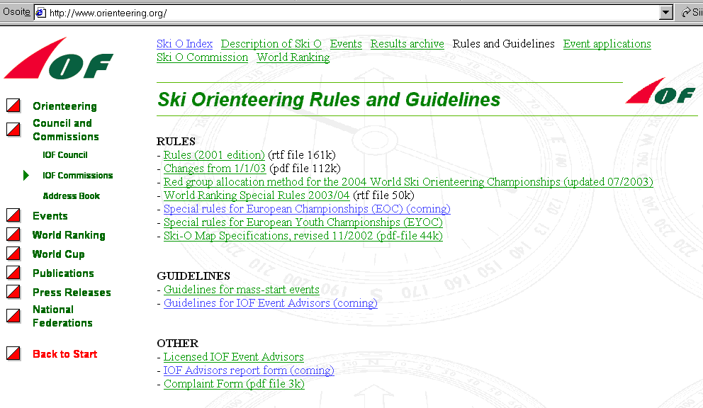
- Specification for Ski-O map in Internet:
- http://www.orienteering.org
|

 Jegyzetek