 |
This magazine is the first (enticing) piece of a new initiative especially to recruit subscribers for the next booklets.
This is the Hungarian translation of the Marshall Cavendish Encyclopedia.
In the last ten years a lot of similar books and encyclopedias were published in Hungary: the original pictures are colourful and marvellous. But the real trial is the map itself. Were the publishers careful enough to spend money and time to convert the original maps into the Hungarian environment or did they just translate some text? Did they ask mapping experts to do this work or just ask somebody to translate words into Hungarian?
The map of this booklet is a good example of a bad tendency: if the map is good in some countries it surely will be appropriate in all countries, in Hungary too?
Take a look at the most clumsy errors of the map:
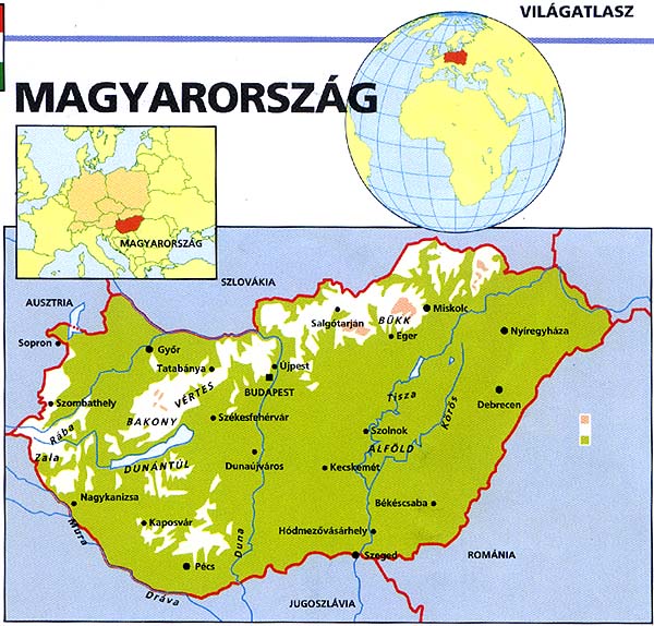
- Checking the bordering countries it is squealing that in the southern part we have only one neighbour: Yugoslavia. Our northeastern neighbour is not named. Probably the map was made before 1991.
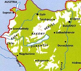
- Or was it made much earlier? Újpest is a part of Budapest since 1951 (by the way it is shown at the wrong side of the Danube).
- The drawing of rivers are too draft, some of the major rivers are missing, the river Körös is totally wrong. The name of rivers are placed opposite to cartographic traditions.
- The Lake Velence is missing.
- The main reason of mistakes comes from a misterious misfit of black elements. It is not an error in the printing process because the other black elements of the page are correct. The placement of cities and their names are incorrect according to other elements (rivers): e.g. the city Sopron is drawn outside the Hungarian border.
- They probably planned to have a legend on the right, but the text is missing.
- There are several rough errors in the hypsometric colouring. The largest point of Western Hungary (892 m) is totally missing.
|