INVITATION

MAPS FOR ENVIRONMENT
conference and exhibition
Dr. István Klinghammer
Chief of faculty
ELTE Department of Cartography
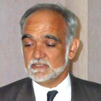
Károly Brezsnyánszky
Director
Geological Institute of Hungary

Conference schedule:October 14-16, 1999
Conference site:Eötvös Loránd University of Sciences
Department of Cartography
Address: 1117 Budapest, Pázmány Péter sétány 1/A, HUNGARY
Conference objectives:
  • Exchange of experience between experts engaged in investigating and protecting the environment
  • Raising public awareness concerning the significance of map-based representation
  • Setting up an exhibition collection commemorating the millennium of Hungary
  • Making a historical overview
  • Raising the popularity of map representation
Conference organisers:
  • Faculty of Cartography of the Eötvös Loránd University of Sciences
  • Geological Institute of Hungary

Preliminary program

October 14 morningProfessional and popular lectures
October 14 early afternoonProfessional and popular lectures
October 14-15Exhibition, consultations
October 14 late afternoonSubmission of exhibition awards
October 16Excursion for foreign guests


Official languages of the conference: Hungarian, English.
The Organising Committee ensures the summarising translation of presentations.

No registration fee is charged!


The need for maps representing our environment first on paper then on digital media has appeared since mankind requires spatial modelling of the real world. Though preparation methods and outward appearance has constantly been changing, maps will be required in the future as well. The recent developments in information technology resulting in decisive changes in storage media, processing techniques, data maintenance as well as publishing gave a significant impetus to this process.
The introduction of the new tools reduced significantly the time required for processing steps and analogous techniques have been replaced by computer-aided, digital methods. Simultaneously, the processing equipment has completely been changed. The apparent simplification of map processing does not diminish the role of experts at all, though some conception changes have taken place. One of the most important of them is database support. The challenge of producing exact, aesthetic maps meeting strict quality requirements is as significant today as it was centuries ago.
The first maps were limited to the analogous representation of the geographic environment. The advance of scientific disciplines urging a multidisciplinary approach of investigating the environment like geology, pedology, meteorology, statistics gave rise to thematic mapping. During the latest decades, maps based on multidisciplinary approach used as decision support tools in addressing environmental issues have initiated the preparation of derived maps based on data coming from diverse sources. Their efficient processing cannot be realised without digital technology.
The millennium of the foundation of the Hungarian state, the approaching turn of the century, the inauguration of the new building of the Eötvös Loránd University of Sciences as well as the traditional yearly conferences "GIS for Environment" held by the Geological Institute of Hungary are events deserving a respectful commemoration. The Organising Committee wishes therefore to review the historical background and achievements in the field of cartography present the equipment and technological background of map design try to assume future developments present and popularise cartography in public and for young experts organise an exhibition on the achieved results and latest technology.
The conference will be organised in the lecture halls and the gallery of the new Lágymányos building of the Eötvös Loránd University of Sciences. The Organising Committee kindly invites foreign and Hungarian experts wishing to hold a lecture, exhibit maps as well as visitors wishing to participate in the conference.