|
|
|
(in English) |
|
|
|
|
|
|||
|
|
Medieval Churches and Monasteries |
|
|
|
|
|
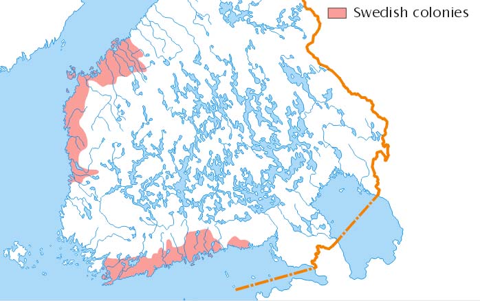
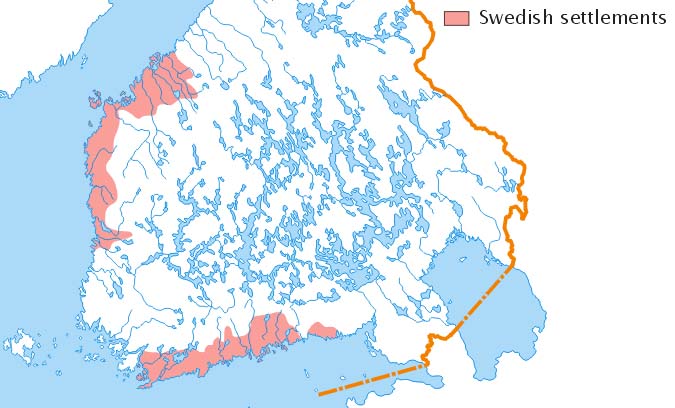
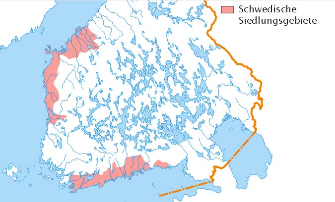
Swedish settlements in Finland |
|
|
|
|
|
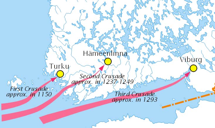
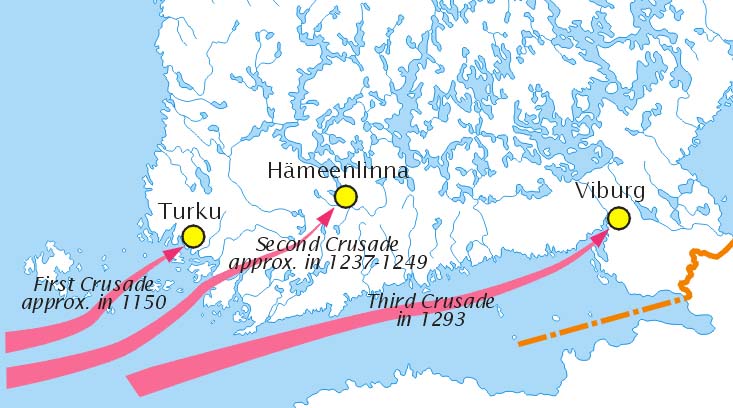
Crusades to Finland |
|
|
|
|
|
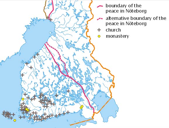
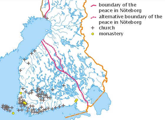
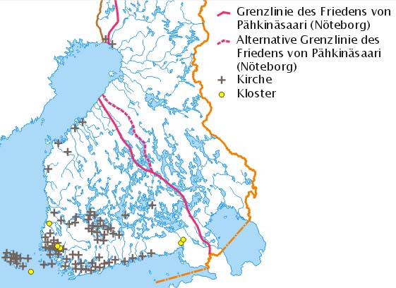
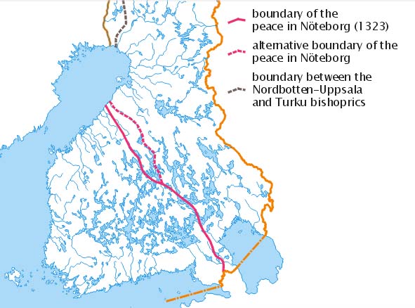
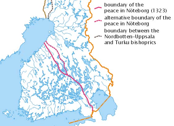
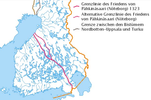
The Boundary of the Treaty in Nöteborg in 1323 |
|
|
|
|
|
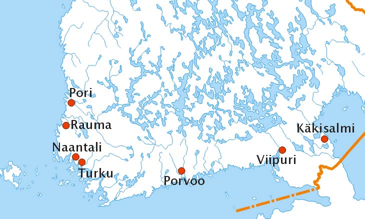
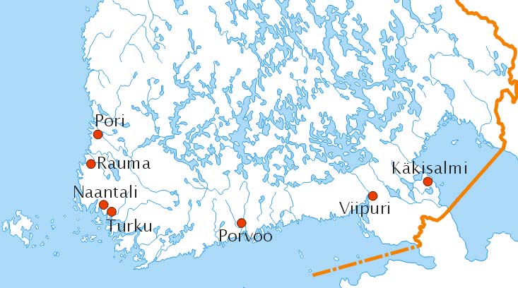
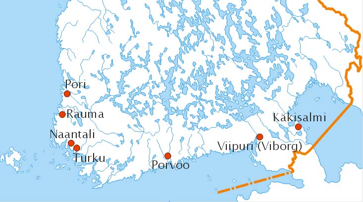
Medieval towns |
|
|
|
|
|
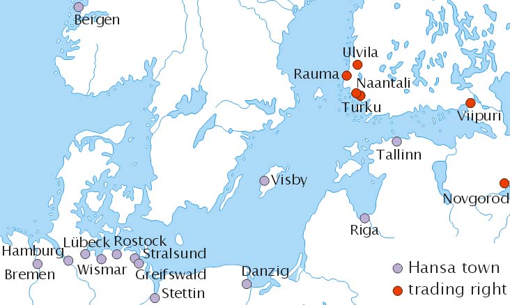
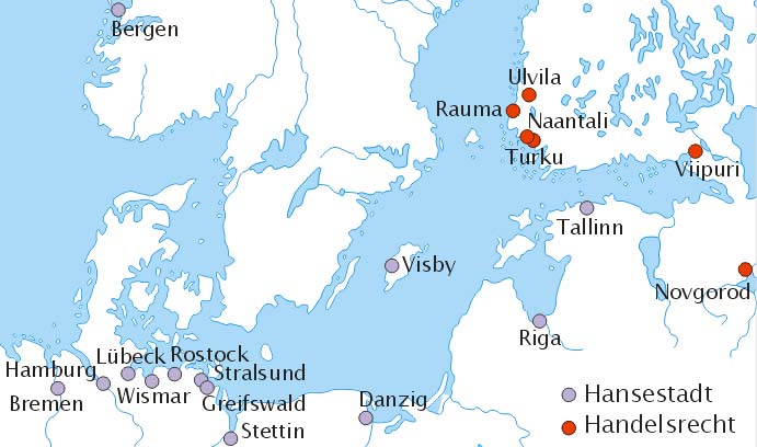
The Hansa in the area of the Baltic Sea |
|
|
|
|
|
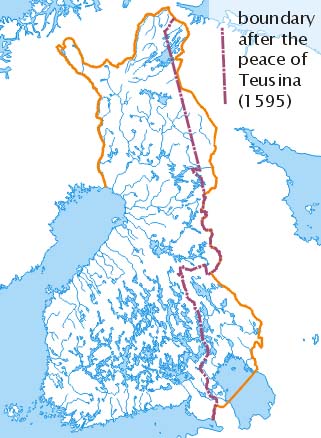
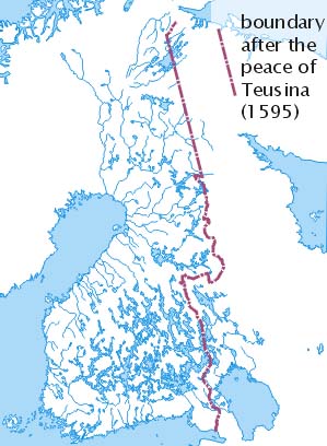
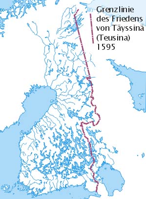
State Border after the Peace Treaty in Teusina 1595 |
|
|
|
|
|
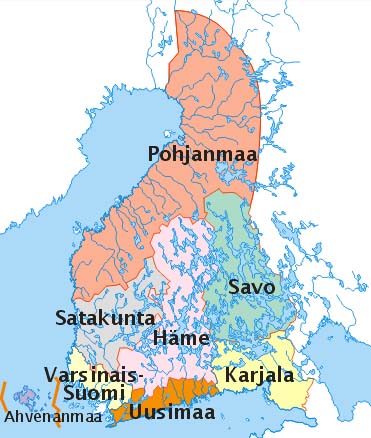
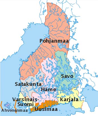
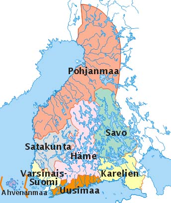
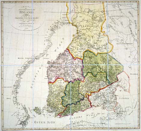
Historical Counties |
|
|
|
|
|
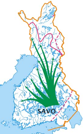
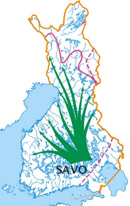
The New Savo Settlements of the 16th century |
|
|
|
|
|
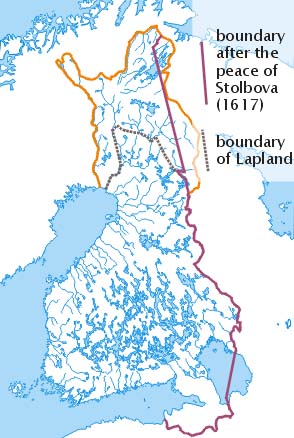
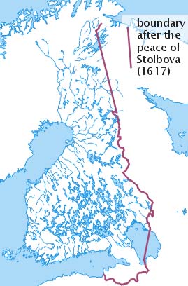
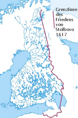
The Border-line of Stolbova Peace Treaty 1617 |
|
|
|
|
|
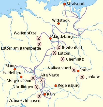
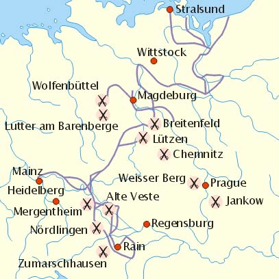
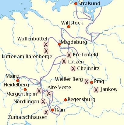
The Swedish Campaign during the Thirty Years War |
|
|
|
|
|
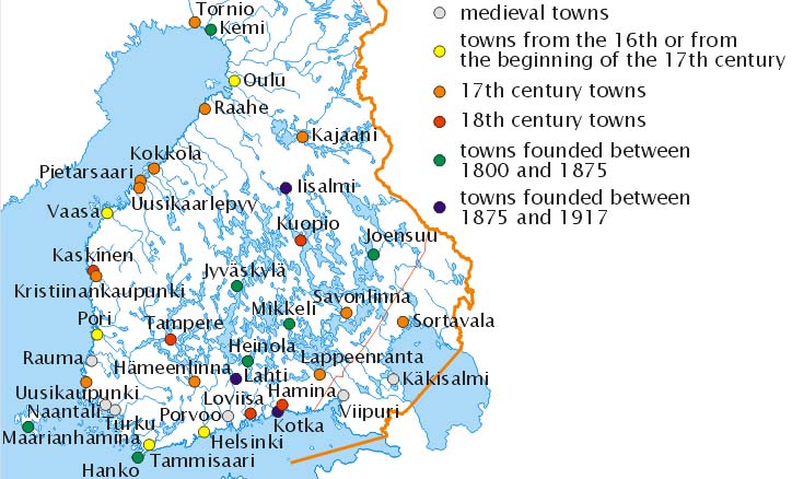
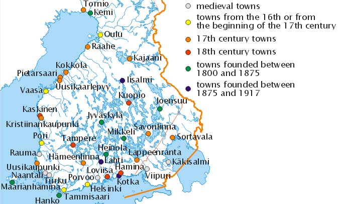
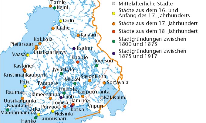
New towns |
|
|
|
|
|
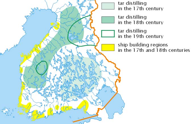
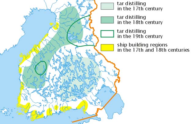
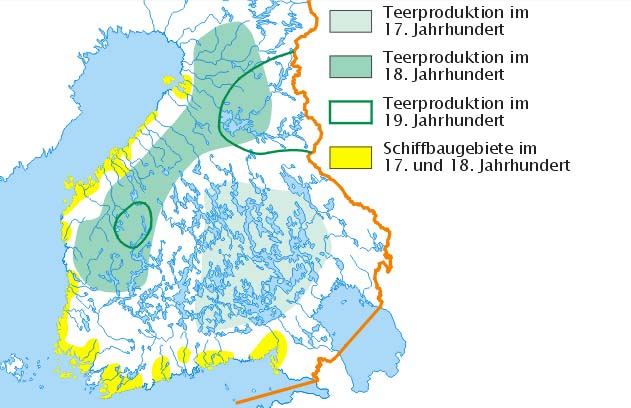
Tar-burning in Finland |
|
|
|
|
|
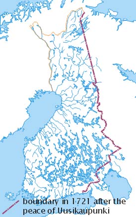
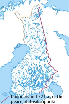
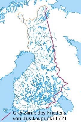
The Border of Uusikaupunki Peace Treaty, 1721 |
|
|
|
|
|
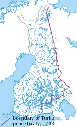
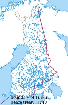
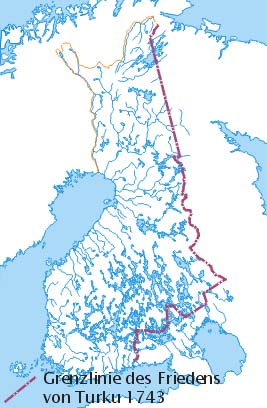
The Border of Turku Peace Treaty |
|
|
|
|
|
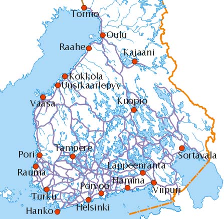
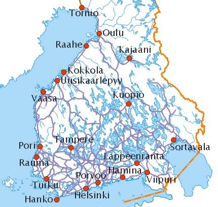
Roads in Finland in the end of the Swedish rule (1807) |
|
|
|
|
|
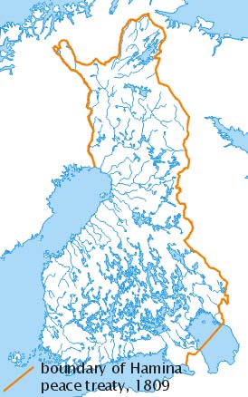
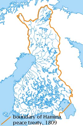
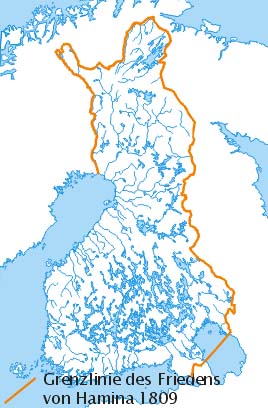
The Border of Hamina Peace Treaty - Autonomous Finland |
|
|
|
|
|
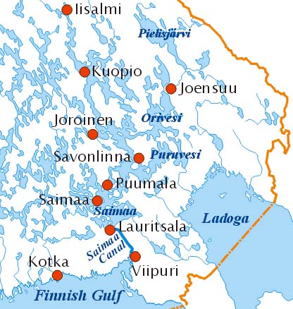
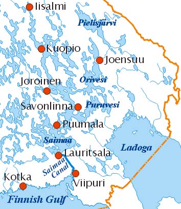
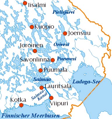
The Saimaa Canal Saima Canal and its sphere of influence |
|
|
|
|
|
Railroads in 1917 |
|
|
|
|
|
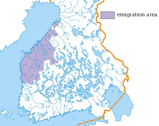
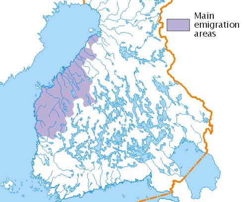
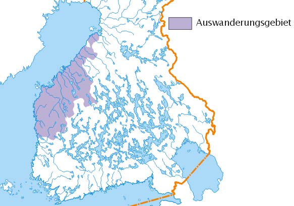
Emigration to North-America |
|
|
|
|
|
The Crimean War on Finnish Waters (REJECTED) | |||
|
|
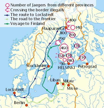
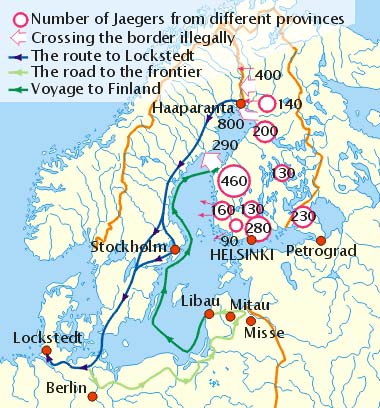
The Route of Jaegers to Germany |
|
|
|
|
|
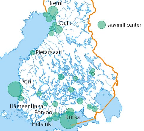
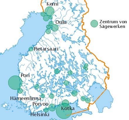
Saw mills |
|
|
|
|
|
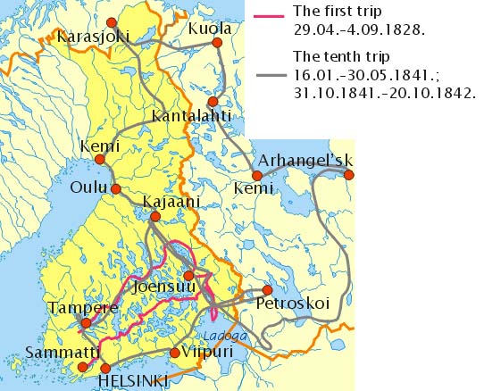
Lönnrot's Travels |
|
|
|
|
|
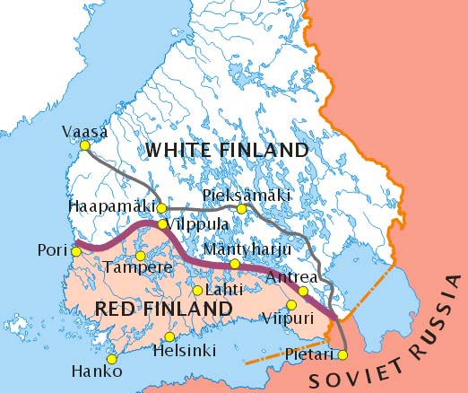
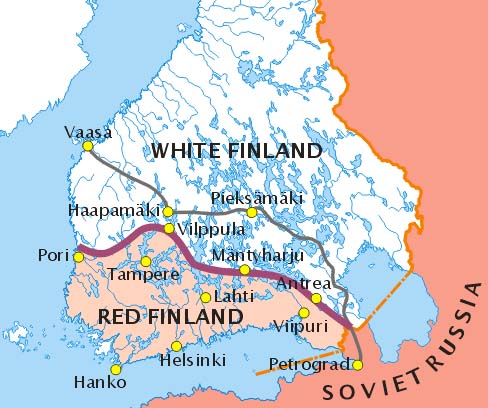
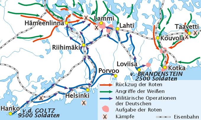
Red and White Finland: Front Line in 1918 |
|
|
|
|
|
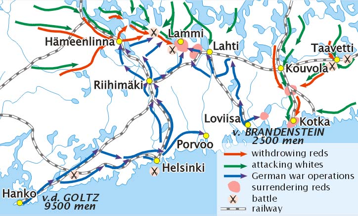
The Route of the German Baltic Division in 1918 |
|
|
|
|
|
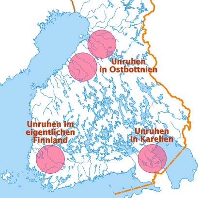
Popular Movements during the Great Depression |
|
|
|
|
|
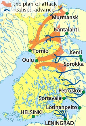
The Plan of Attack of the Red Army in November, 1939 |
|
|
|
|
|
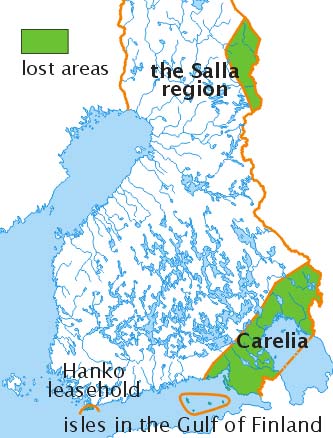
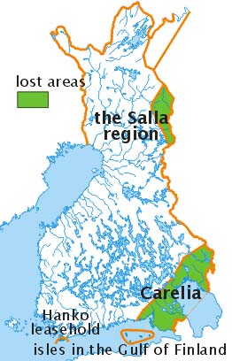
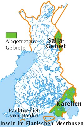
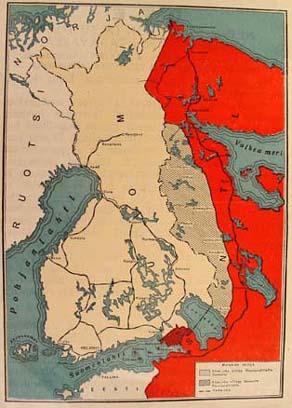
Borders of Finland in 1940 |
|
|
|
|
|
The Route of the Hungarian Volunteers to Finland 1939-1940 (REJECTED) | |||
|
|
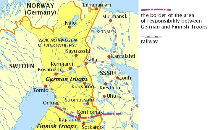
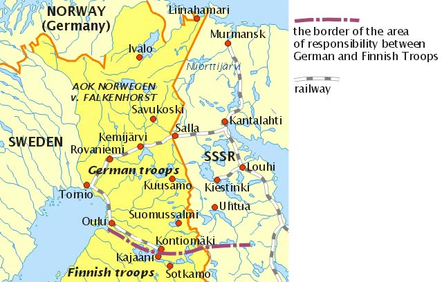
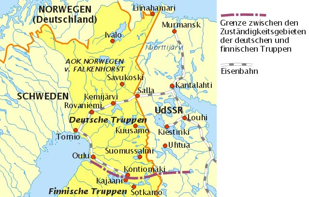
The German Army in Finland 1941-1944 |
|
|
|
|
|
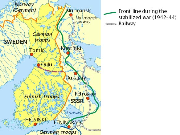
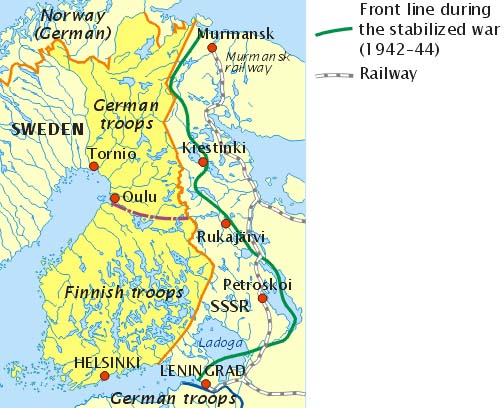
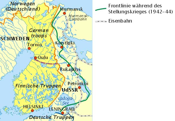
Front Lines of the Continuation War, 1941-1944 |
|
|
|
|
|
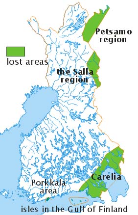
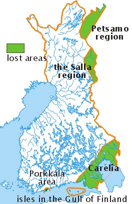
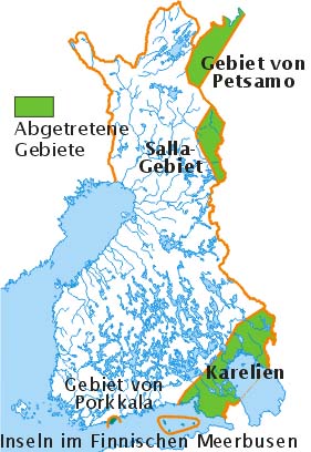
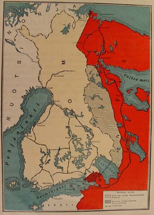
Border of Finland after the Paris Peace Treaty, 1947 |
|
|
|
|
|
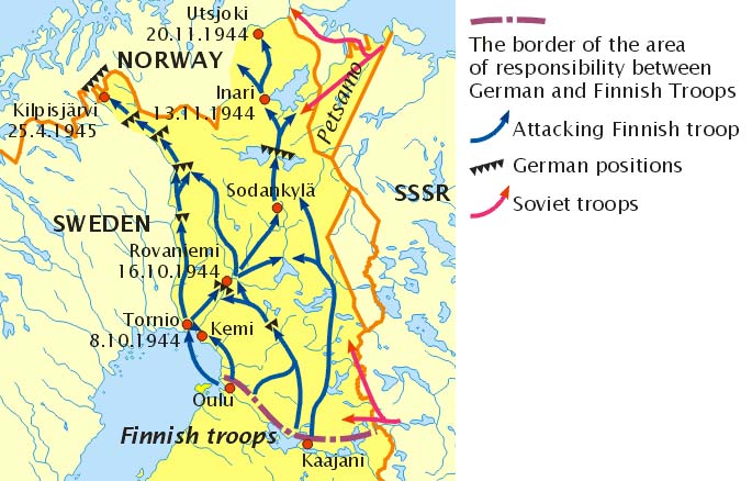
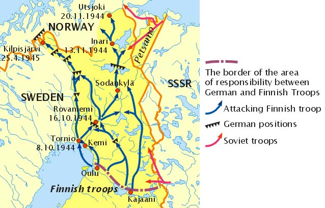
The War in Lapland, 1944-1945 |
|
|
|
|
|
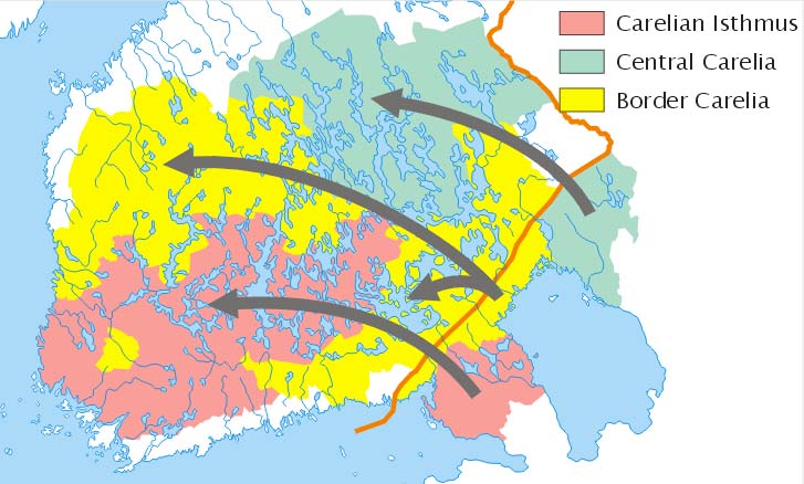
The Settlement of the Evacuees |
|
|
|
|
|
||||
|
|
|
|
|
|
|
|
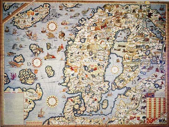
A contemporary map: Carta Marina |
|
|
|
|
|
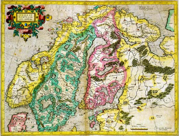
A Contemporary map: Mercator |
|
|
|
|
|
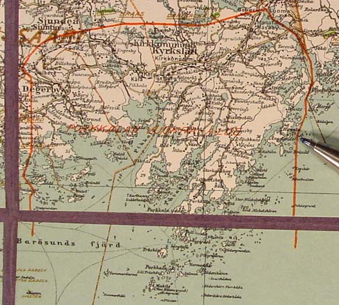
The Great Coastal Road |
|
|
|
|
|
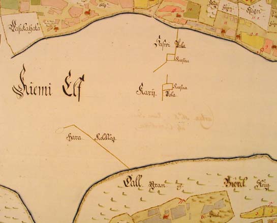
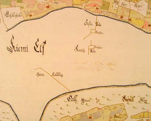
Salmon-dams in Kemi-river |
|
|
|
|
|
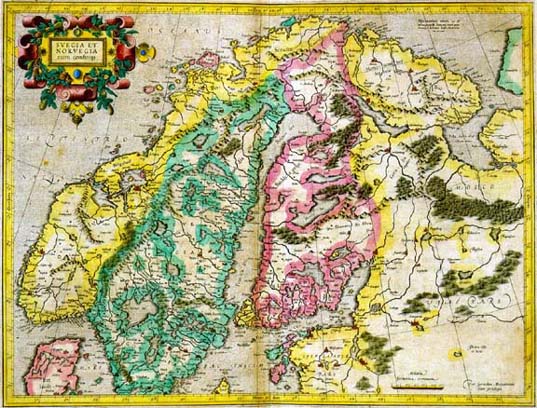
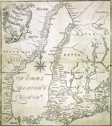
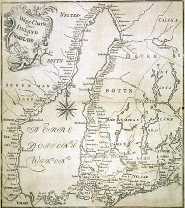
Contemporary map: General map of Sweden |
|
|
|
|
|
Propaganda Leaflet Prepared by the Terijoki government, 1939 |
|
|
|
|
|
Porkkala Area, leased to the USSR, 1944-1956 |
|
|
|