Maps: Counties and regions of Hungary
Warning!
Maps of our web server were not published yet in a traditional paper form.
Only the non-profit use of these images are allowed.
Don't delete the author's name from the images!
Links to the maps of other Hungarian webservers are marked with:  .
.
Zentai László
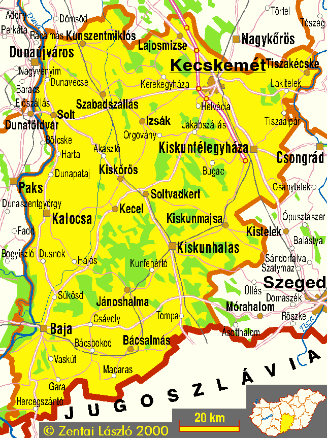
- Bács-Kiskun county (transport, main settlements) - 61104 bytes
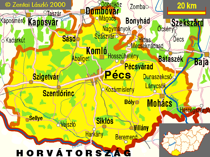
- Baranya county (transport, main settlements) - 55081 bytes
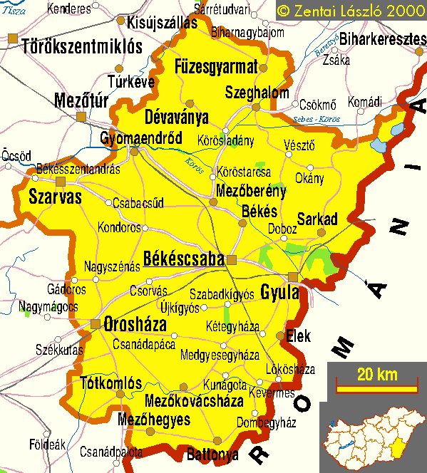
- Békés county (transport, main settlements) - 36959 bytes
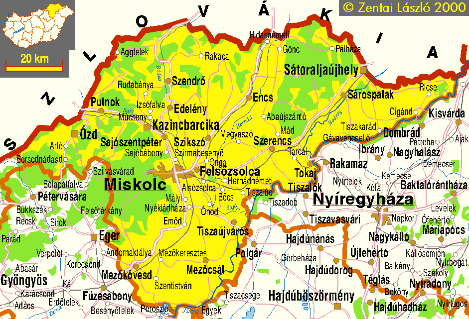
- Borsod-Abaúj-Zemplén county (transport, main settlements) - 71330 bytes
- Csongrád county (transport, main settlements) - 39102 bytes
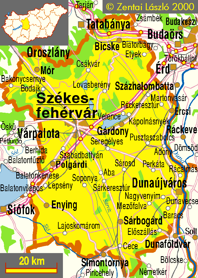
- Fejér county (transport, main settlements) - 73837 bytes
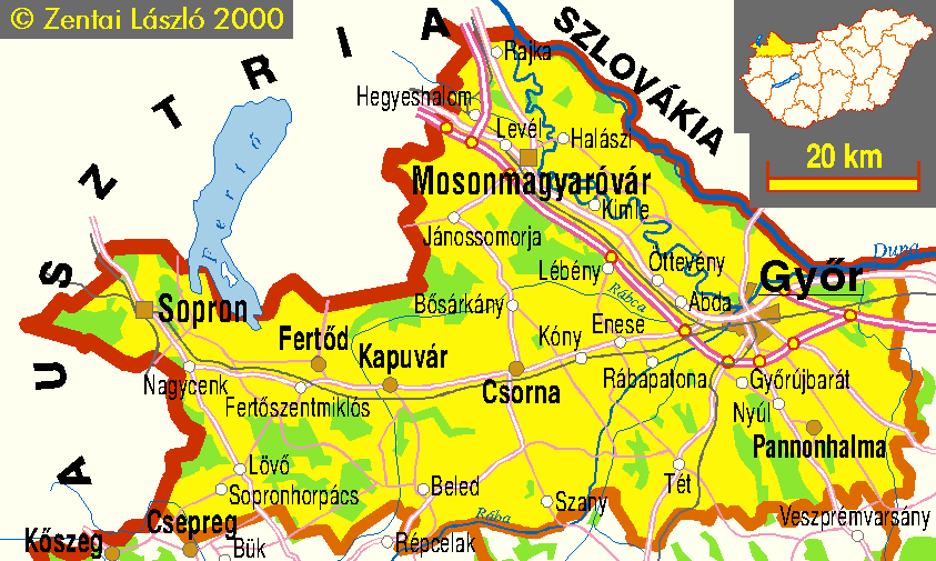
- Győr-Moson-Sopron county (transport, main settlements) - 40759 bytes
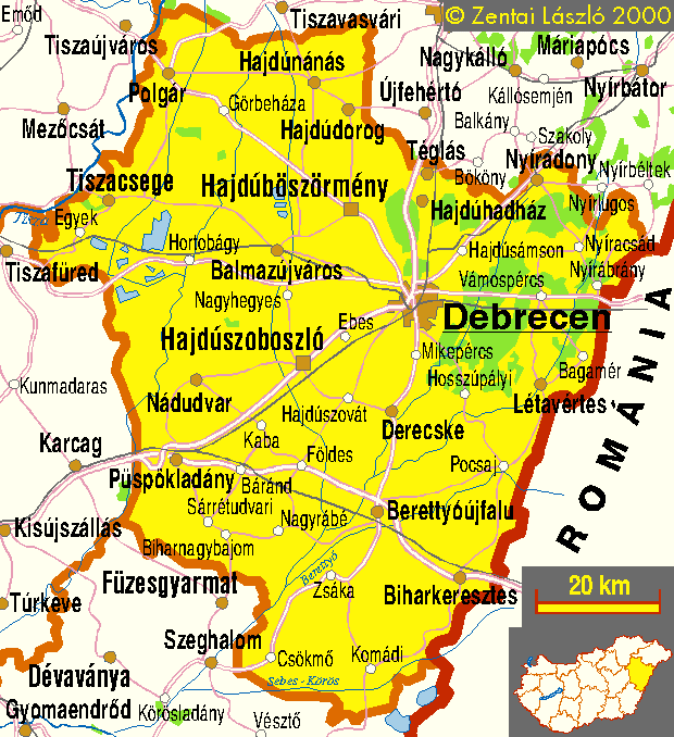
- Hajdú-Bihar county (transport, main settlements) - 47630 bytes
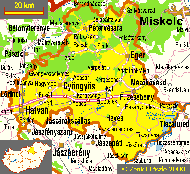
- Heves county (transport, main settlements) - 57718 bytes
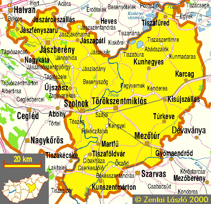
- Jász-Nagykun-Szolnok county (transport, main settlements) - 55060 bytes
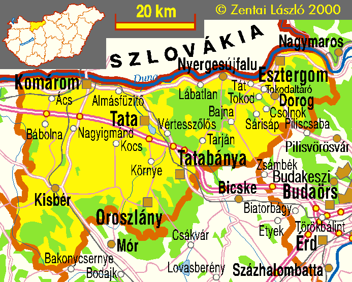
- Komárom-Esztergom county (transport, main settlements) - 45713 bytes
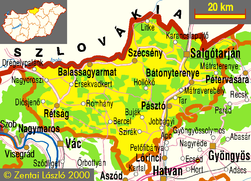
- Nógrád county (transport, main settlements) - 50386 bytes
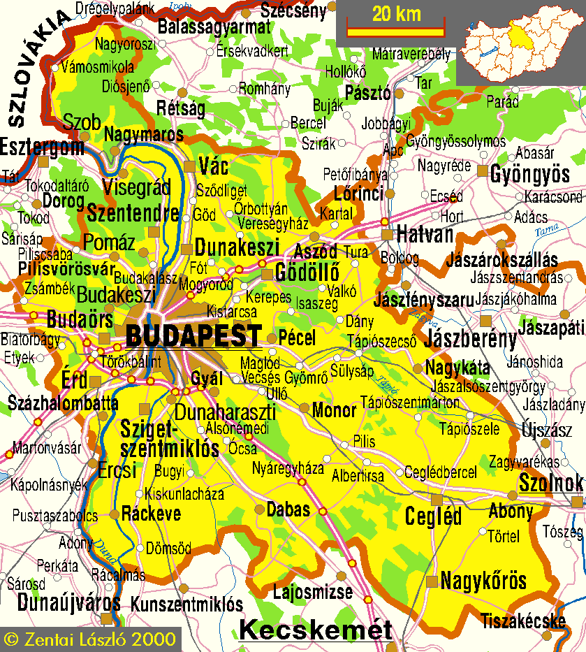
- Pest county (transport, main settlements) - 102851 bytes
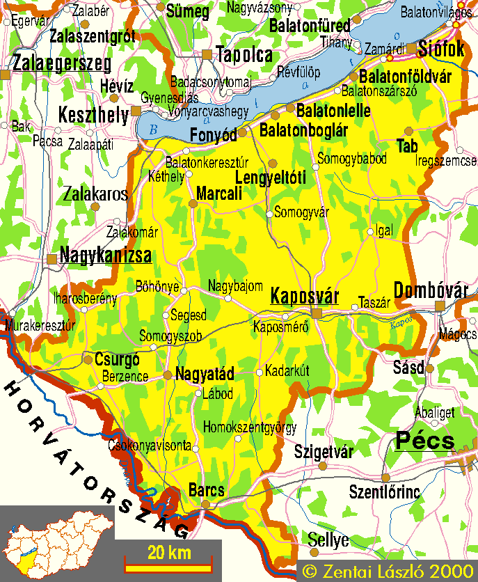
- Somogy county (transport, main settlements) - 70218 bytes
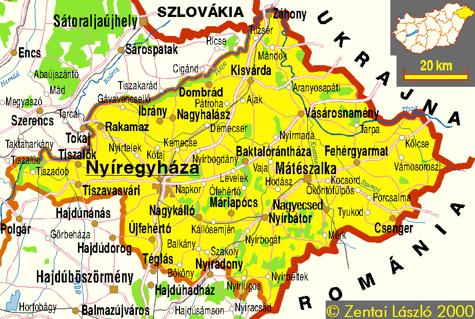
- Szabolcs-Szatmár-Bereg county (transport, main settlements) - 62805 bytes
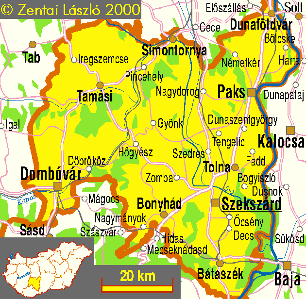
- Tolna county (transport, main settlements) - 44808 bytes
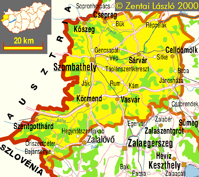
- Vas county (transport, main settlements) - 45183 bytes
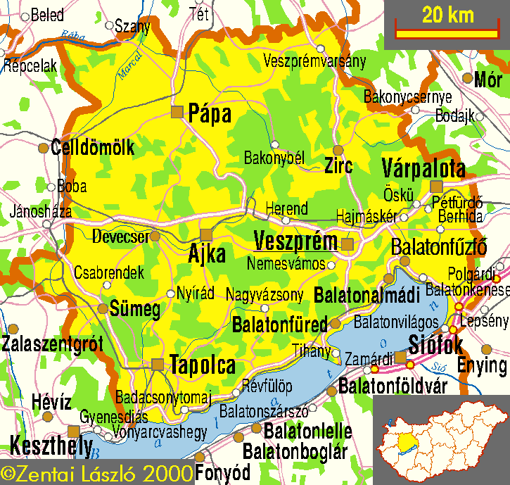
- Veszprém county (transport, main settlements) - 60489 bytes
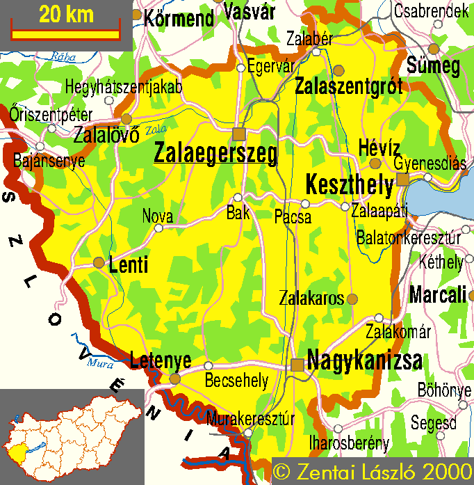
- Zala county (transport, main settlements) - 52706 bytes
- A Velencei-hegység térképe
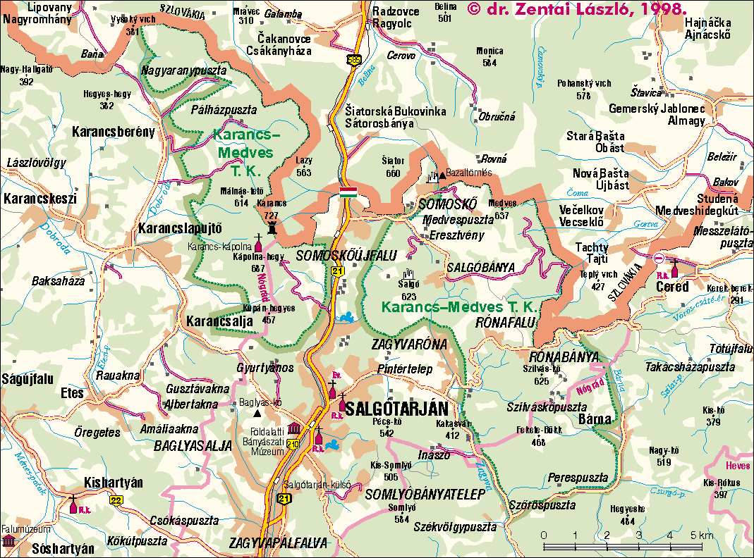
- Karancs-Medves Tájvédelmi Körzet
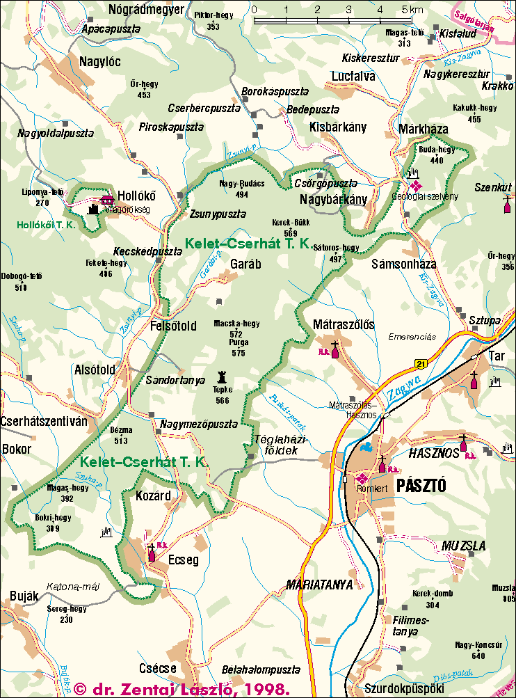
- Kelet-Cserhát Tájvédelmi Körzet
- Szatmár-Bereg Tájvédelmi Körzet
- Different county maps
- Parts of Bács-Kiskun county
- Balaton: east side - west side
- Balaton
- South side of Balaton
- Békés megye
- Békéscsaba and surroundings
- Borsod-Abaúj-Zemplén county
- Csepel Island
- Fertő-tó
- Győr-Moson-Sopron megye tájegységei
- Győr-Wien
- Gyula and surroundings
- Hajdú-Bihar county
- Hanság
- Heves megye
- Jászberény and surroundings
- Somogy county
- Szigetköz
- A Tisza-tó (Lake Tisza) and surroundings
- Tolna county (maps)
- Velence Hills
- A Velencei-tó (Lake Velence) and surroundings
- Veszprém county (tourism)
- Zemplén
1:500000 scale maps about the whole country (plug-in required)
 Back to the Map Collection!
Jump to the Homepage of Department of Cartography and Geoinformatics, Eötvös University, Budapest!