S5: Field Collection Systems
20. examples - no. 2.
A historic example from the Mediterranean:
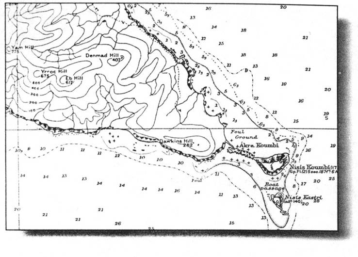
This is a British hydrographic chart showing part of a Greek island. The surveying vessel, under command of Captain Corry, sent a party of sailors to the island to survey it. They did not like it, as can be seen from the names of the Hills on their map:
Yam, Yrroc, Eb and Denmad.
If you reverse these names, it says:
May Corry be damned!
|
|
||
|
|
|
|
Home
|
Selfstudy
|
S5:
Fieldwork
Š2002 ICA optimised for
browsers version 4 or higher on 1024x768 screen